We use cookies, along with some third-party sites (like Google, Facebook, etc.). By continuing to visit this site you agree to our use of cookies.


- Search Yachts
- Destinations
- Company
- Sailing info
- Blog
Need help? Contact us

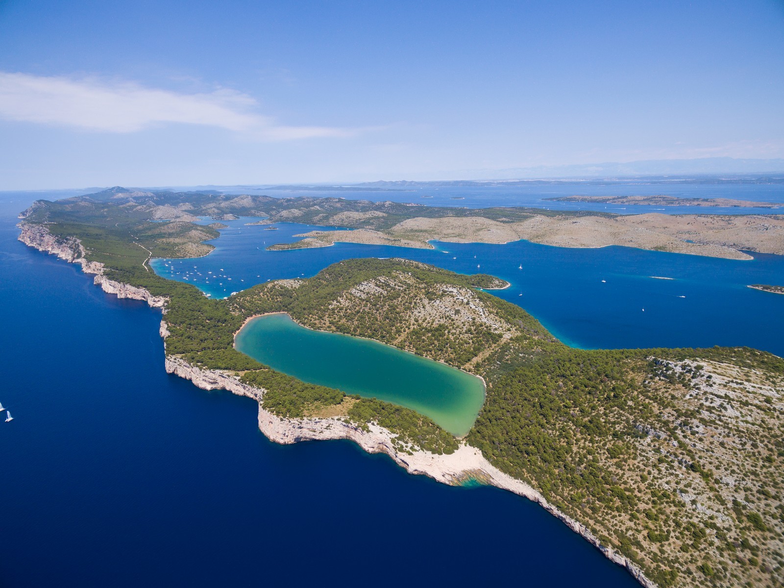
The largest of the northern Dalmatian islands. A limestone ridge interspersed with fertile karstic plains runs along the entire length of the island, with the highest point at Vela Straza (338 m). The southwestern side is steep and rocky, while the other parts of the coast fall gently towards the sea and are lined with bays and coves, the most beautiful of which are Soliscica, Sakarun, Pantera and Telascica. There are no springs or streams on the island. The northeastern coast is lined with numerous offshore islets. All 11 settlements lie on the northeastern side of the island. The largest one is Sali. The main economic activities are agriculture, wine growing, olive groves and fishing. A modern road linking all the settlements winds along the island and affords spectacular views. The southern part of the island borders on the Kornati National Park. The oldest evidence of the settlement of the island dates back to the Neolithic period. The remains of lllyrian fortifications lie on the exposed hills. In 1460 Dugi otok was mentioned under the name of Veli otok.
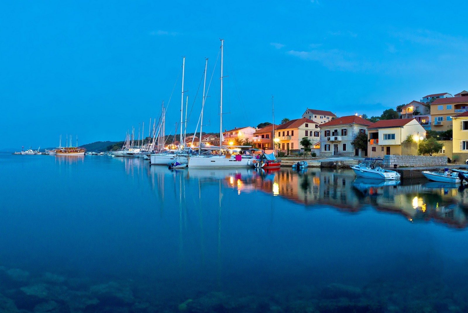
BOZAVA - This settlement with a small port is the most developed tourist centre on Dugi otok. There are numerous opportunities for sports and recreation both at sea and on land. The low limestone coast is surrounded by a pine forest. Bozava is a world famous diving centre. It was settled in the lllyrian period. The remains of lllyrian structures are visible on the Kruna and Gracina hills. The settlement was first mentioned in written sources in 1327. The Parish Church of sv. Nikola (St. Nicholas) contains three Gothic processional crosses from the 14th and 15th centuries, and the cemetery Church of sv. Nikola (St. Nicholas) boasts an impressive Gothic wooden crucifix from the 15th century. Both churches were built in the 9th or 10th century. The settlement features interesting courtyards surrounded by stone walls with loopholes, which were built as a defence against pirates in the 18th century. The popular harbour, considered by some to be the most beautiful on the island, offers mooring lines, electricity hook-ups and water. It is exposed only to southeasterly winds, which make the sea choppy.
BRBINJ - A settlement between two picturesque bays on the northwest part of Dugi otok, surrounded by a pine forest and olivi groves. Brbinj is served by two international ferry lines, Rijeka Brbinj-Starigrad-Korcula-Sobra-Dubrovnik-Bari and Zadar-Brbinj Ancona, as well as the regular ferry line to Zadar. The shipyart in the Lucina Bay builds and repairs all types of boats and smal ships. Brbinj was first mentioned at the end of the 12th century. Above the settlement lies an lllyrian stone mound. The Lucina Bay is protected from all sides except the north western. Boats can berth in the harbour, or at the ferry landin-when there is no ferry. There are several mooring buoys in the bay, so anchoring is not necessary. The Bok Bay is exposed t northeasterly winds. Berths are available in the harbour at depth of 3 m, and there are mooring buoys in the northern part of the bay. The buoys are made fast to the coast to ensure safe mooring.
SALI - The largest settlement on Dugi otok is an economic centre, a fishing port and an important tourist destination. It was named after the abandoned saltpans. Sali was first mentioned in 1105 as the property of a Zadar monastery. Its development was greatly influenced by fishing, he Gothic Parish Church of sv. Marija (St. Mary) was built in le middle of the 15th century. Interesting secular buildings elude three Renaissance houses and a Baroque house. The first breakwater is occupied by fishing boats and the second, smaller one by local boats. Berths are therefore only available in the harbor which is exposed to the southeasterly wind.
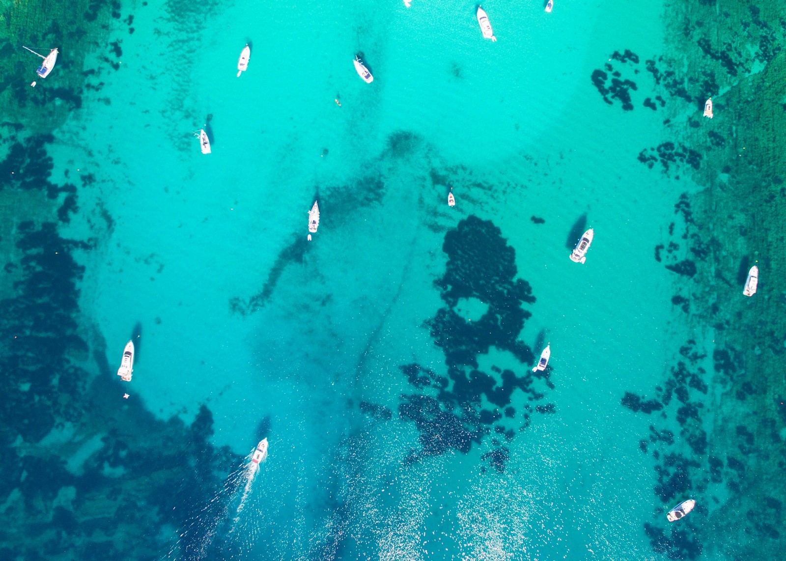
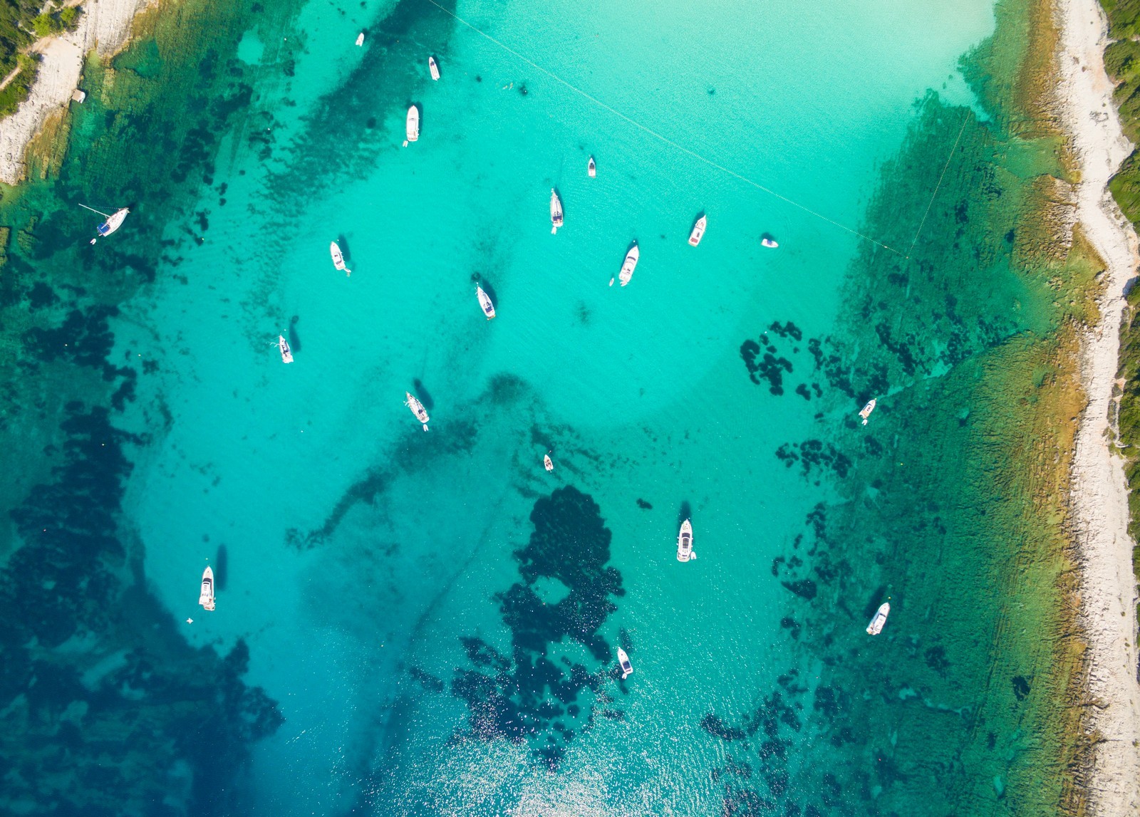
SAKARUN - One of the most beautiful bays on this part of the Adriatic, particularly in the afternoon. The beach is pebbly and the seabed sandy. The bay is exposed to southerly and southeasterly winds. Anchorage is available at depths between 5 and 10 m.
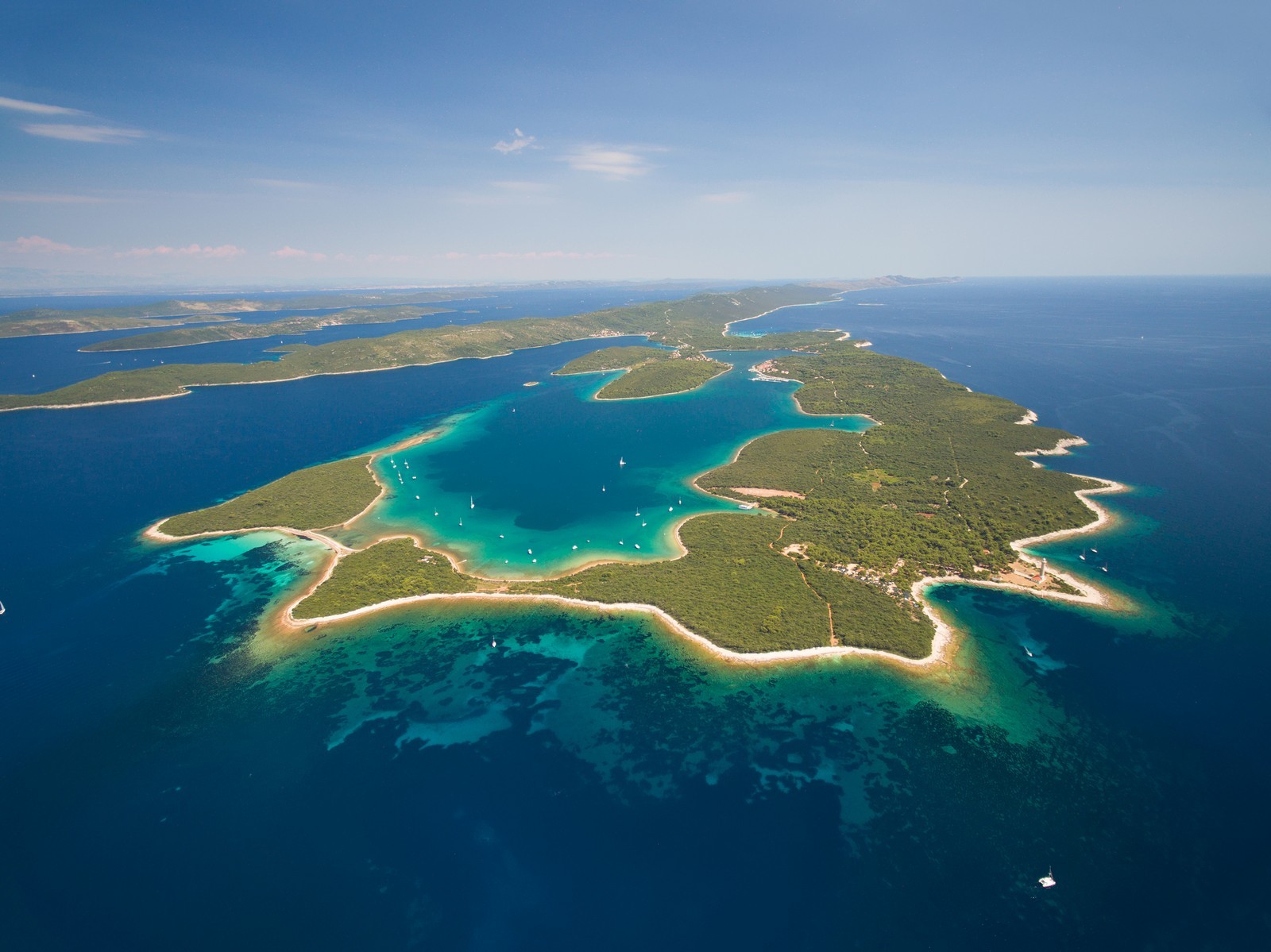
TELASCICA - A bay and natural harbour on the southern part of Dugi otok, protected as a nature park. There are 25 coves and 5 islands in the 10-km-long bay which cuts deep into the coast. The total length of the bay's coast is the astounding 68 km. The sea is up to 12 m deep in the inner part of the bay and over 60 m deep in the outer. A special phenomenon is a salt-water lake. On an islet stands the high Vela Sestrica lighthouse, towering above the labyrinthine southern entrance into the bay. Telascica is one of the largest and most beautiful bays on the Adriatic. The nature park is visited by a large number of nautical tourists. Due to its size and shape it is divided into four parts. The first, eastern part is not suitable for anchorage expect for large boats, due to its size and depth. The second part (the Mir Bay) has mooring buoys, a phone booth and an inn. There are small harbours which were once intended for military ships in the eastern part, but their design makes berthing difficult. There are mooring buoys in the third part along the northern coast. In the fourth part, the buoys are located north and south of the entrance, and the best anchorage can be found behind the two islets or between the northern islet and the coast.
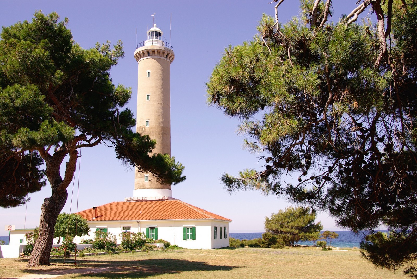
VELI RAT - A small settlement on the northwestern part of Dugi otok. Its untouched natural surroundings and beautiful sea attract many nautical tourists. One of the largest and most beautiful lighthouses on the Adriatic, built in 1849, stands on Cape Veli Rat northwest of the settlement. It has two apartments in which tourists can spend their vacations. There is an inn in the settlement and a beautiful beach in the vicinity. Veli Rat was first mentioned in 1327. The Church of sv. Ante (St. Anthony) probably dates from the same period, but was later reconstructed. The L-shaped pier has space for two large boats. When the northwesterly blows, the sea is choppy. Along the coast lie a few small piers with depths between 1 and 2 m.
CUNA - An almost completely enclosed bay which provides anchorage in all its parts and mooring buoys. The entrance is 2.5 m deep and 30 m wide. The sea is 3.5 m deep and the muddy bottom provides a good hold. The winds are fairly strong because of the low configuration of the land, but they do not cause waves.
PANTERA - A popular anchorage for many sailors. There are mooring buoys in the northern part. Anchorage should be chosen with regard to the winds which are blowing at the given moment.
ZAGLAV - A settlement above the Triluke Bay on the southeastern part of Dugi otok with a well-protected ferry landing (Zadar). The settlement was mentioned in the 15rt century. The monastery and the Church of sv. Mihovil (St. Michael) date from the same period. Boats can berth at the ferry landing only briefly because there is little space for boats. Anchorage is located in the southern part between the settlement and the breakwater and is exposed to northerly winds. There is a gas (fuel) station for boats.The harbour for small boats has a launch ramp and is protected by a breakwater. Large boats can berth at the inner side of the breakwater at a depth of 3 m. The inner part of the harbour is enclosed by two small piers with depths between 1.5 and 2 m.


We are very social bunch. Get in touch!