We use cookies, along with some third-party sites (like Google, Facebook, etc.). By continuing to visit this site you agree to our use of cookies.


- Search Yachts
- Destinations
- Company
- Sailing info
- Blog
Need help? Contact us

An island in the Central Dalmatian island group with its highest point at Hum (587 m). The southern and southeastern coasts are lined with numerous coves with small pebbly and sandy beaches. There are a few islets in front of the southeastern coast. On the western coast lies the wide Komiza Bay, and on the northeastern coast the fairly enclosed Viska luka Bay. There are no surface streams and the only springs are located in the area of Komiza, but the island has a modern water reservoir. The fertile fields at the top of the island, where most of the settlements are located, are mainly used to grow wine.
The largest settlements on the island. Vis and Komiza, are connected by two roads. Along with wine growing and vegetable gardening (spring vegetables), the main economic activity is fishing, but there have been increased investments into tourism, because the island is once again open to everyone after the period between 1945 and 1989 when foreigners were only occasionally allowed to visit this strategically important island. Vis was settled in prehistoric times by the Ilyrian tribe of Liburni. The Greeks established a colony called Issa, which later became an independent polis that established its own colonies in Dalmatia. In 47 B.C. the island came under Roman rule.
In the Middle Ages it frequently changed hands. It was under Venetian rule from 1420 to 1797, when it came under Austrian and Austro-Hungarian rule along with the rest of Dalmatia. It first entered the annals of recent history on July 20,1866, when the memorable naval battle of Vis was fought between the Italian and Austrian fleets. The battle was won by the Austrian navy led by Admiral Tegetthoff. After the defeat of Yugoslavia in April 1941, Vis was occupied by Italy. After Italy capitulated in September 1943, the liberated island was defended against German attacks by Partizans from all over Dalmatia. At the end of 1943 and the beginning of 1944, the main Partizan and Allied base with the Supreme Command of the Yugoslav National Liberation Army was established on the island. Below the peak of Hum on the northeastern side lies Titova spilja (Tito's Cave), which served as the main Partizan headquarters in 1944.
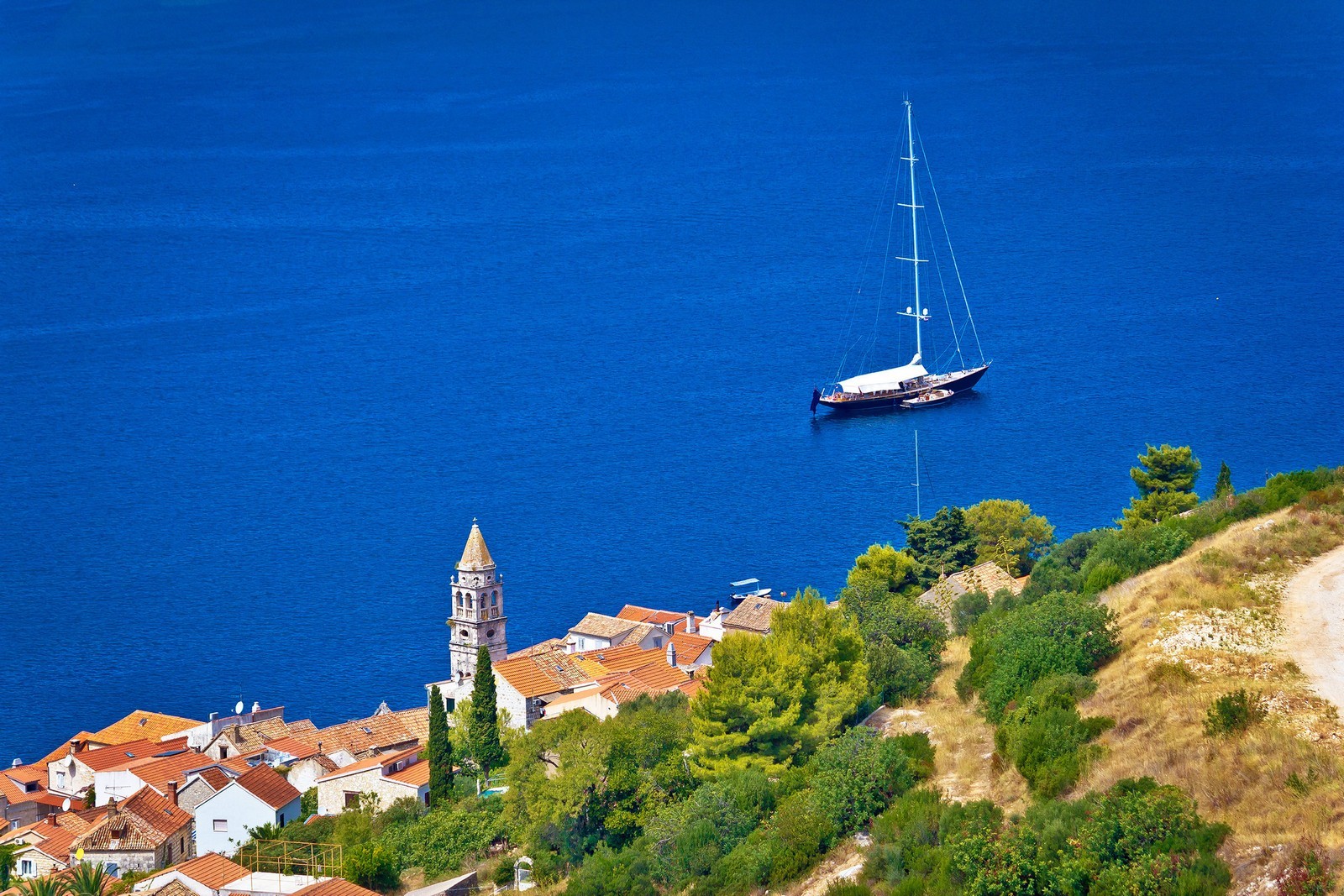
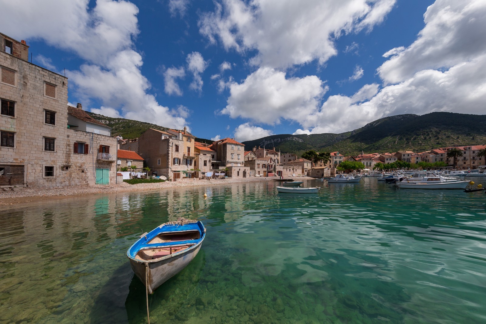
KOMIZA - A town with a port on a wide bay that opens to the southwest on the western coast of Vis, at the foot of the steep Hum hill. The main economic activities are wine growing, vegetable gardening, fishing, fish processing and tourism. The sandy town beach lies in front of the hotel, and there are several similar beaches on the eastern coast of the bay. Two roads connect Komiza with the town of Vis. A regular ship line and several seasonal tourist ships connect it with the island of Bisevo. To the west lie the seasonally inhabited island of Svetac (Sveti Andrija) and the volcanic islet of Brusnik which provides a habitat for twin-tailed lizards.
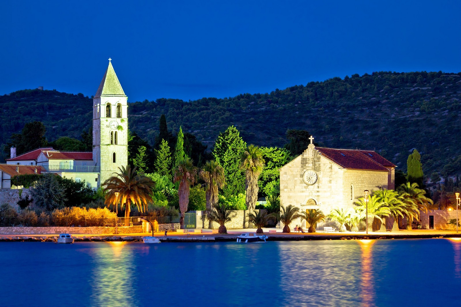
The settlement was first mentioned in written sources in the 12th century. In the second half of the 13th century, the Benedictine monks from the neighboring island of Bisevo built the Monastery of sv. Nikola (St. Nicholas). The monastic complex with a church, a defense tower and a defense wall from the 17th century has been preserved. A fortification from 1585 with an interesting small museum and Zonko's House from the 16th century stand in the port. At the northern edge of town next to the town beach stands the Church of Our Lady of the Pirates, the patron saint of fishermen from the 16th century. The Church of sv. Mihovil (St. Michael) from the 12th century is situated on a saddle (310 m) by the new road to Vis.
The port is protected from the westerly and southwesterly winds by a 200-m-long breakwater with a depth of 6 m, which also provides the safest berths. There are mooring lines with water and electricity hook-ups. The port is exposed to southerly winds, which agitate the sea. When the northerly winds blow, there is a strong tide. Numerous local boats are tied to mooring buoys in the port.
MILNA - A permanently inhabited hamlet on a bay. Berths are available at a small pier at a depth of 4 m. There is a good anchorage along the middle of the bay at a depth of 8 m. In the neighboring Zaglav Bay lies the largest beach on the island.
OKLJUCNA - The fishing bay of the charming but sadly almost abandoned hillside village of the same name. There are a few houses in the bay, which are only inhabited during the summer, and a small 2.5-m-deep harbor which is mostly occupied and is exposed to northerly and northwesterly winds. Anchorage is suitable only in fair weather.
ROGACICA - A fishing hamlet on the Parja Bay northwest of Vis, with which it is connected by a road. On the northern side, the bay is enclosed by Cape Nova posta, which is dotted with bunkers and military observation points. The best anchorage is located below the cape along the western coast of the bay.
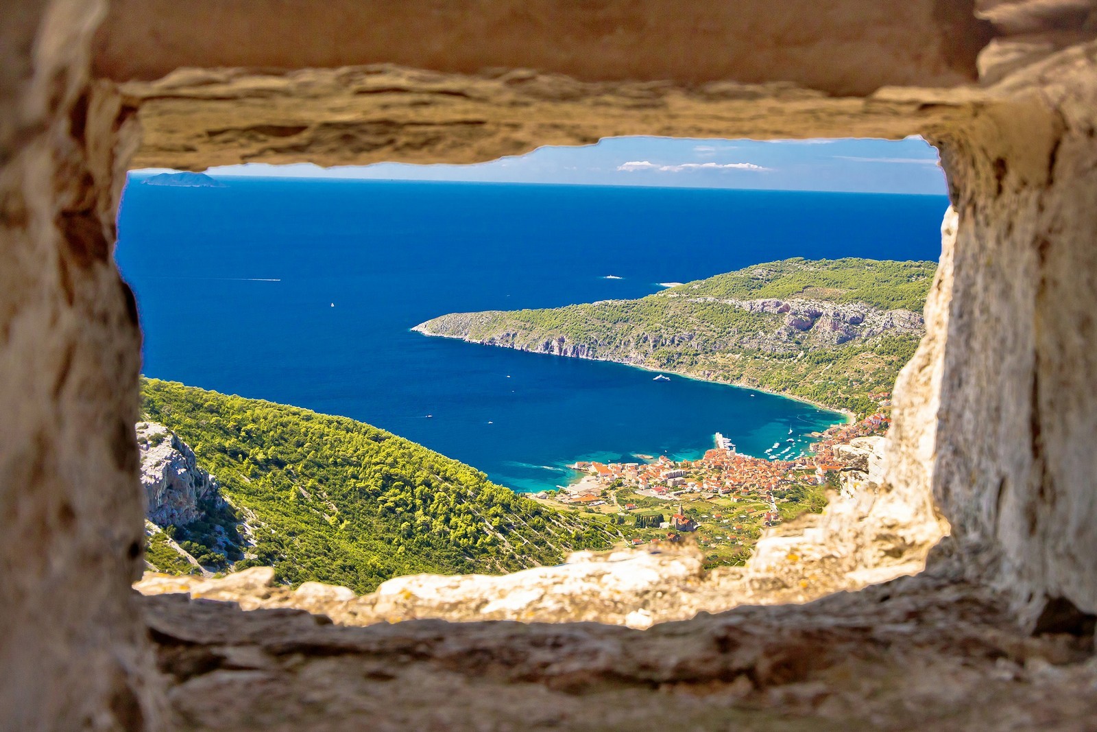
RUKAVAC - A large bay with the only large settlement on the southern coast of the island. Berths are available at a 20-m-long pier with a depth of 3 m. The bay provides the safest anchorage on the southern side of the island, because the islet of Ravnik protects it from the jugo.
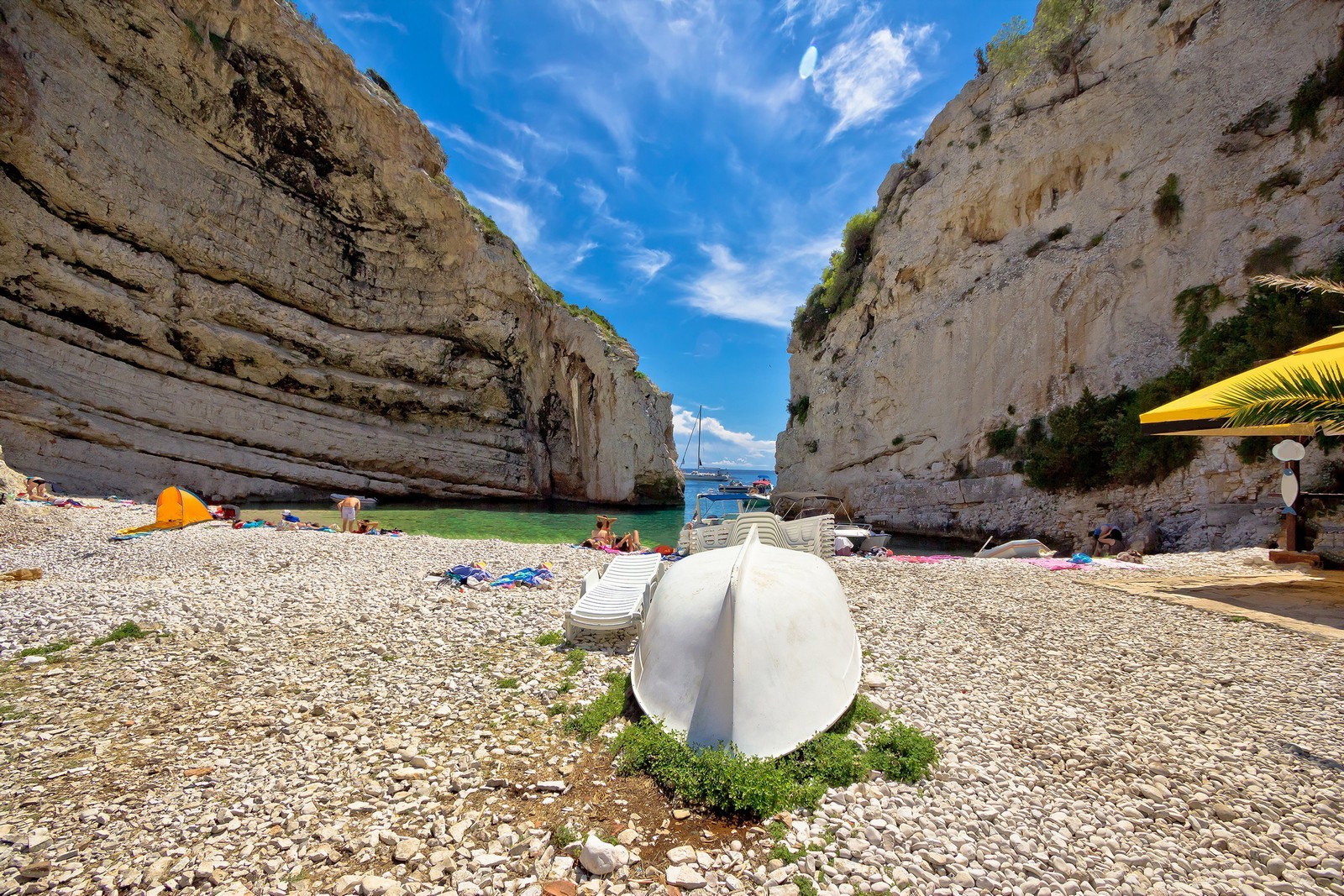
STINIVA - The most attractive and interesting bay on the southern coast of the island. It cuts deep into the coast and is surrounded by steep inaccessible cliffs on both sides. There are a few uninhabited fishing houses at the end of the bay, which have retained their original appearance and are protected as a natural reserve along with the bay. The bay's fascinating underwater world attract divers as well.
STONCICA - A well-known bay east of the town of Vis. Of the approximately fifty houses on the bay, only a few are permanently inhabited. Boats can berth at piers in front of the houses. There is an anchorage in the middle of the bay at depths between 5 and 6 m, but the bottom does not provide the best hold. The bay is protected from all winds. Strong northerly winds cause whirlpools. One of the most beautiful lighthouses on the Adriatic stands on Cape Stoncica.
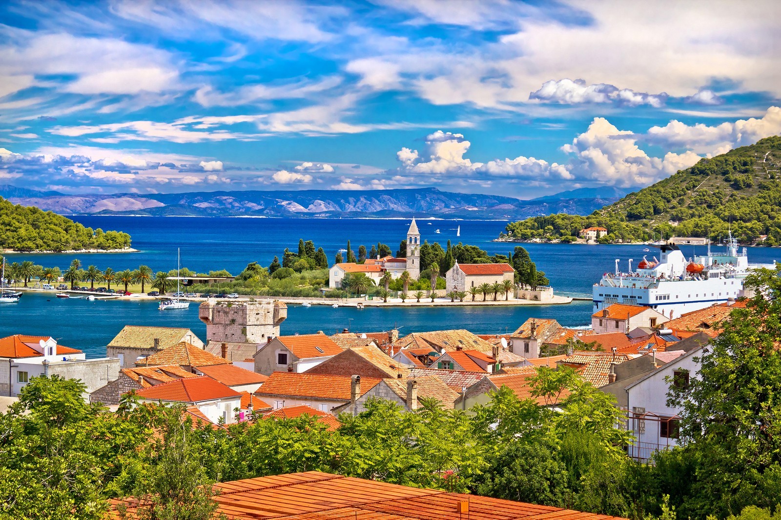
VIS TOWN - A town with a port on the Viska luka Bay on the northeastern coast of the island. The main economic activities are agriculture, wine growing, fishing and tourism. The town arches around the bay from the old part called Kut to the new part called Luka. There is a ferry landing (Split). Two roads connect it with the town of Komiza on the opposite side of the island. There are sandy and pebbly beaches nearby. Traces of the past include the remains of the Greek town of Issa on the slope of Gradina, of the first Greek colony on the eastern Adriatic coast, of a Roman spa, and of a large Roman theater on the Prirovo Peninsula. A monastery with a church was built in the 16th century. The town's attractions include the Gariboldi Palace from 1552 and the summer mansion of the poet Marin Gazarovic from the 17th century. There are four defense towers from the 17th century at the edge of town.
The Church of Our Lady of Spilica dates from around 1500, and the Churches of sv. Ciprijan (St. Cyprian) and sv. Duh (the Holy Ghost) from the 17th century. British fortresses called Wellington, Bentick and Robertson from the beginning of the 19th century stand at the outskirts of town. The former Austrian army barrack houses the Issa Gallery and the Regional Museum.
The port lies on a wide and deep bay. Boats can berth in a 4-m-deep harbour or tie up to one of the mooring lines with electricity and water hook-ups. Anchorage is available in the northwestern part of the bay east of the fuel dock. The pier in the western part of the port is reserved for the ferry. Berthing in the port is not advisable when the bora or the jugo blows. The jugo blows from the east in this area, and when it does, it is best to anchor in front of the suburb of Kut on the southeastern part of the coast. There is a small knee-shaped pier with a depth of up to 3.5 m behind a peninsula at the beginning of the bay, i.e. in its eastern part. Its berths provide a safe shelter from the bora.
KONOBA ROKI'S - rokis.hr


We are very social bunch. Get in touch!