We use cookies, along with some third-party sites (like Google, Facebook, etc.). By continuing to visit this site you agree to our use of cookies.


- Search Yachts
- Destinations
- Company
- Sailing info
- Blog
Need help? Contact us

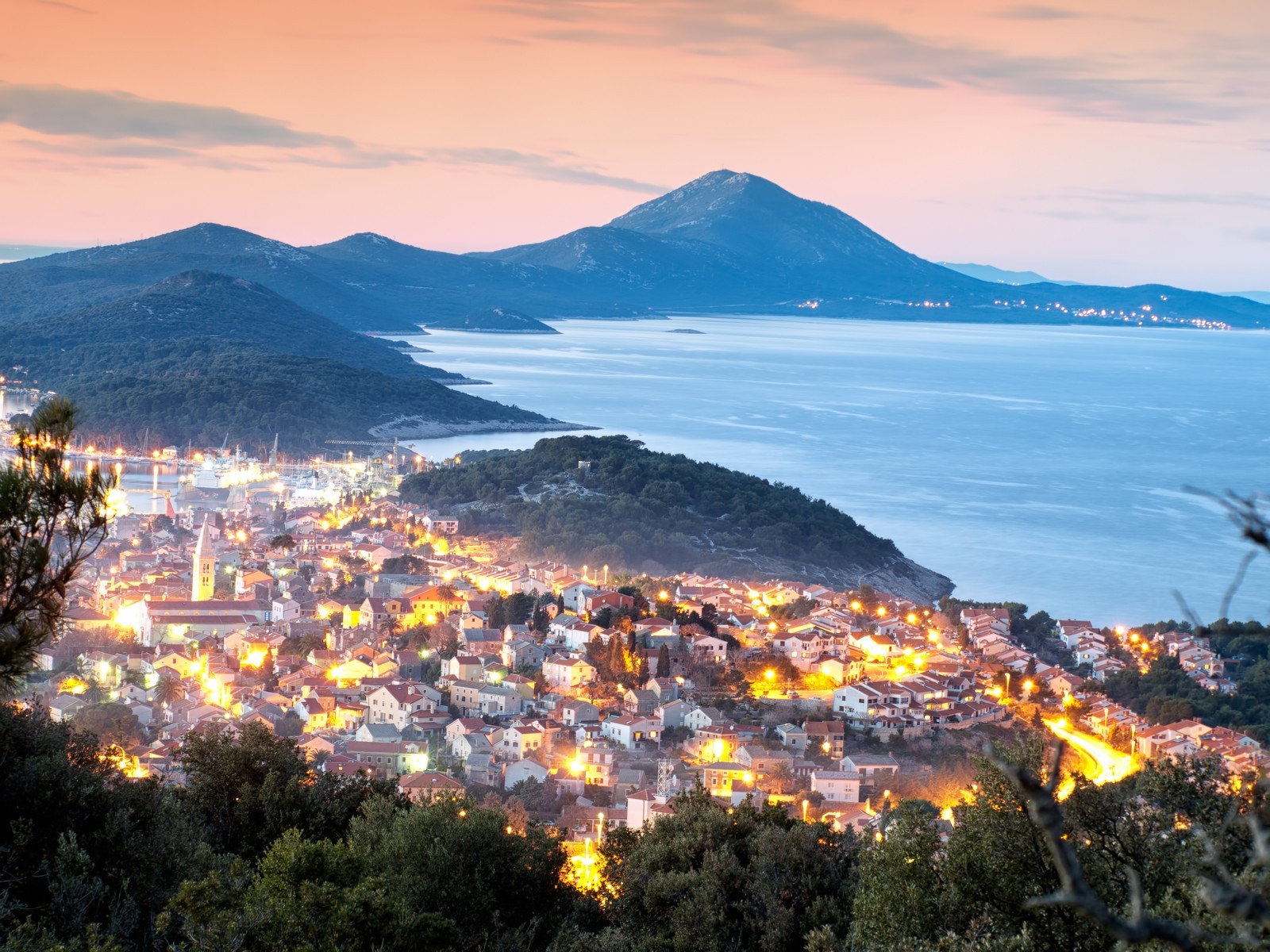
An island in the western group of the Kvarner islands. The islands of Cres and Losinj are only separated by an 11-m-wide artificial canal with a drawbridge that connects the two islands. The northern part of Losinj is wider and includes the long Mt. Osorscica (Televrina, 589 m). The middle of the island is only up to 1 km wide. At Privlaka lies a canal which divides Losinj into two parts and is spanned by a bridge. In the southern part, the island becomes wider again. The northwestern coast is rocky and steep, and is not rugged. The central part of the western coast is very rugged and there are off-shore islands of Unije, Susak, Vele Srakane and Male Srakane. The eastern coast is less steep. Its central part is not rugged and is exposed to the bora. The southeastern coast has numerous bays and several off-shore islets. The areas around Veli Losinj, on Cikat Cape and along the southwestern coast are covered with pine woods. In addition to tourism, the main economic activities are navigation and shipbuilding.
The town of Mali Losinj is the centre of the island and has a port which connects it with the nearby islands. There is also an international airport for smaller planes on the island. The archaeological finds date back to prehistoric times. In antiquity, Losinj and Cres were known by the common name of Apsirtides. They discovered the remains of a few Roman country villas. In the Middle Ages, Losinj was not inhabited. It was the property of the Osor ecclesiastic and temporal feudal lords and followed the fate of Cres throughout its history. A few Romanesque eremitic churches have been preserved. The first inhabitants were mentioned in 1280 and their settlements were granted autonomy by Osor in 1389. The name Losinj first appears in written sources in 1384. During the slow decay of Osor from the 15th century on, the settlements of Veli Losinj and Mali Losinj became more prominent. Trade, shipbuilding and navigation flourished in the 18th and 19th centuries.
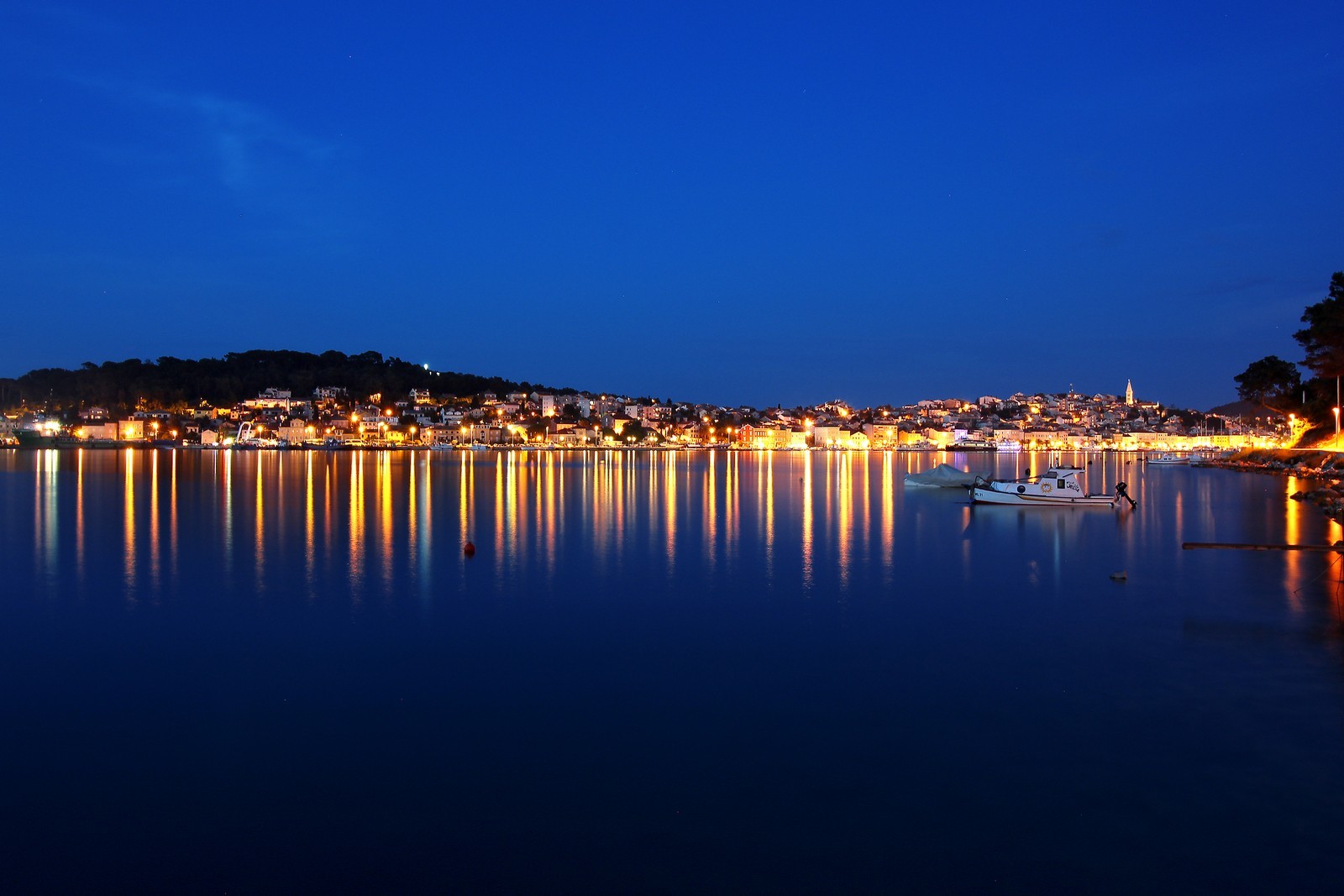
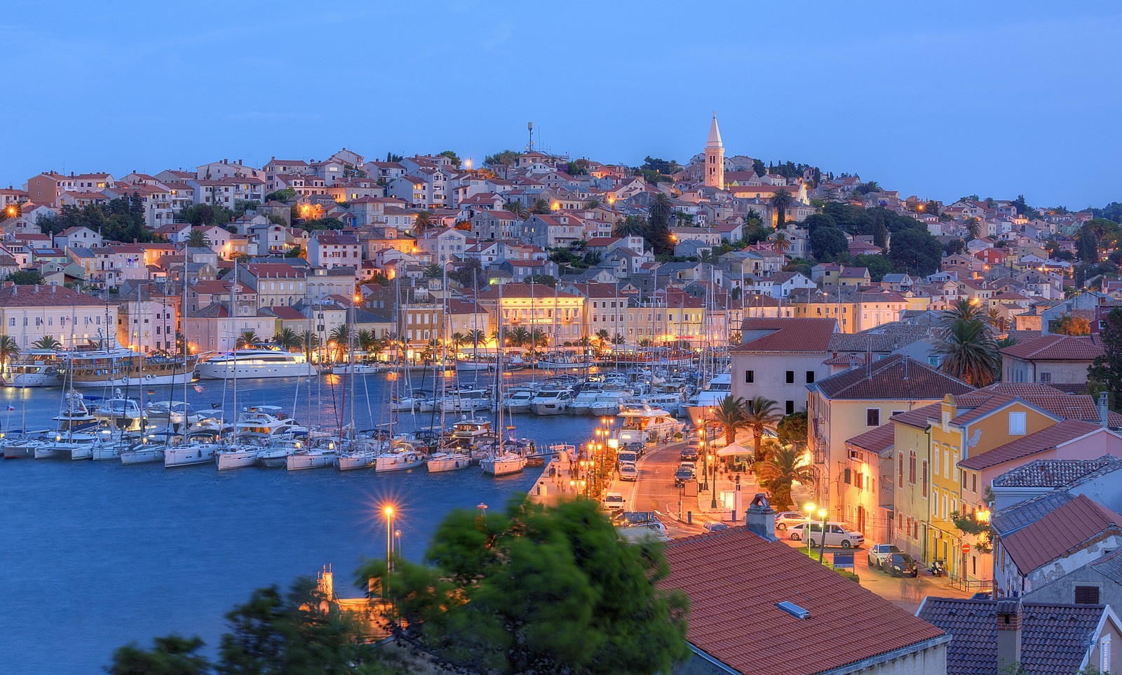
MALI LOSINJ - A town with a harbour and a large tourist centre on the southeastern part of a bay that cuts deep into the coast and is protected from all winds. It is the largest settlement in the Cres-Losinj island group. The houses line the bay in a semi-circle. The sunny eastern side has the greatest concentration of houses. Mali Losinj is a vibrant town with diverse tourist facilities. A trail called Beli put (White Trail) climbs to the top of the island, and then continues along the ridge to the far edge of the island. It affords a breathtaking view of the mainland, the neighbouring islands, Veli Losinj and Mali Losinj. The island of llovik comes into view at the end of the trail. The settlement was first mentioned in 1398 as Malo Selo on the Sv. Martin Bay. It spread and gradually occupied the hinterland of the wide bay. In the 14th century, it was named Mali Losinj and became an important maritime centre of the northern Adriatic. In 1855, the Losinj navy had three shipyards and 118 long-distance sailing ships. Health tourism began to develop at the same time due to the exceptionally propitious climate with warm winters, beautiful beaches and woods which were planted in 1866.
The main tourist areas of Mali Losinj are Cikat and Suncana uvala. The points of interest include the Church of St. Martin from 1450, the Church of sv. Marija (St. Mary) from 1676, and the remains of a Venetian fortress. The port of Mali Losinj is one of the safest on the Adriatic for boats of all sizes. It is possible to land at the long quay when there is space, but visitors are driven away by tourist and passenger ships that have berths there. The smallest depth of the sea is 2 m. Mooring at the inner end of the port is recommended only in fair weather, but when the bora blows or during a storm, it is better to move to the marina or to the anchorage in the Artatore Bay. Anchorage is also available opposite the Most Straits by the lush pine forest which provides a good protection from the bora. Mali Losinj Marina (051) 231-626 - There are 130 berths at a depth of up to 10 m, 120 spaces for dry storage, a 2-ton lift and a 12-ton travel-lift.
NEREZINE - A settlement on the northeastern side of the island beneath Mt. Osorscica. It is a starting point for the ascent of the Televrina lookout peak. The settlement was first mentioned in the 15. century. Nearby stands a Franciscan monastery built between 1509 and 1515. Nerezine developed from a pastoral settlement into a settlement of fishermen and seamen with a shipyard for wooden boats. Studenac Bays connected Nerezine with the settlement of Sveti Jakov. The small port contains a marina. The bora causes unpleasant waves in the port, and it is dangerous for large boats to enter the bay when it blows. The depth of the sea at the breakwater is up to 3.5 m. There is a small shipyard with a 20-ton movable lift south of the port, where it is possible to berth in case of an emergency. Nerezine Marina (051)237-038 - There are 30 to 50 berths at a depth of up to 4 m, 50 spaces for dry storage, a repair shop, a 3.5-ton lift, a 20-ton travel-lift, and a launch ramp.
VELI LOSINJ - A pleasant town on the southeastern side of the island of Losinj, situated in a hilly, forested area. Veli Losinj has a long tradition - of tourism. Due to its pleasant and healthy environment and mild winters, it was declared a climatic health resort in 1892. It was first mentioned as Velo Selo in 1398. The oldest sacral building is the Church of sv. Nikola (St. Nicholas), which was mentioned in 1384. The old town core with the beautiful houses of former sea captains surrounds the town square. Above the entrance to the harbour stands the Baroque Church of sv. Anton (St. Anthony) from 1774, which houses a gallery with the largest collection of paintings on the Kvarner islands. The former mansion of the Viennese Archduke Charles from 1866 now houses a modern health resort for the treatment of respiratory diseases. Boats can berth at the 100-m-long eastern quay at a depth between 2 and 4 m. At the western quay, the sea is less than 2 m deep and yachts can be beached at low tide. It is exposed to the bora which is best avoided. The inner harbour is reserved for local boats. Luka Rovenska - This port near Veli Losinj is protected by a long breakwater, but when the bora blows, berths are not safe. It is not possible to berth behind the breakwater due to the shallowness of the sea. Berths are available at the pier at a depth of up to 3 m. There are a few mooring buoys in front of it. Excursion boats are often moored there during the day.

We are very social bunch. Get in touch!