We use cookies, along with some third-party sites (like Google, Facebook, etc.). By continuing to visit this site you agree to our use of cookies.


- Search Yachts
- Destinations
- Company
- Sailing info
- Blog
Need help? Contact us

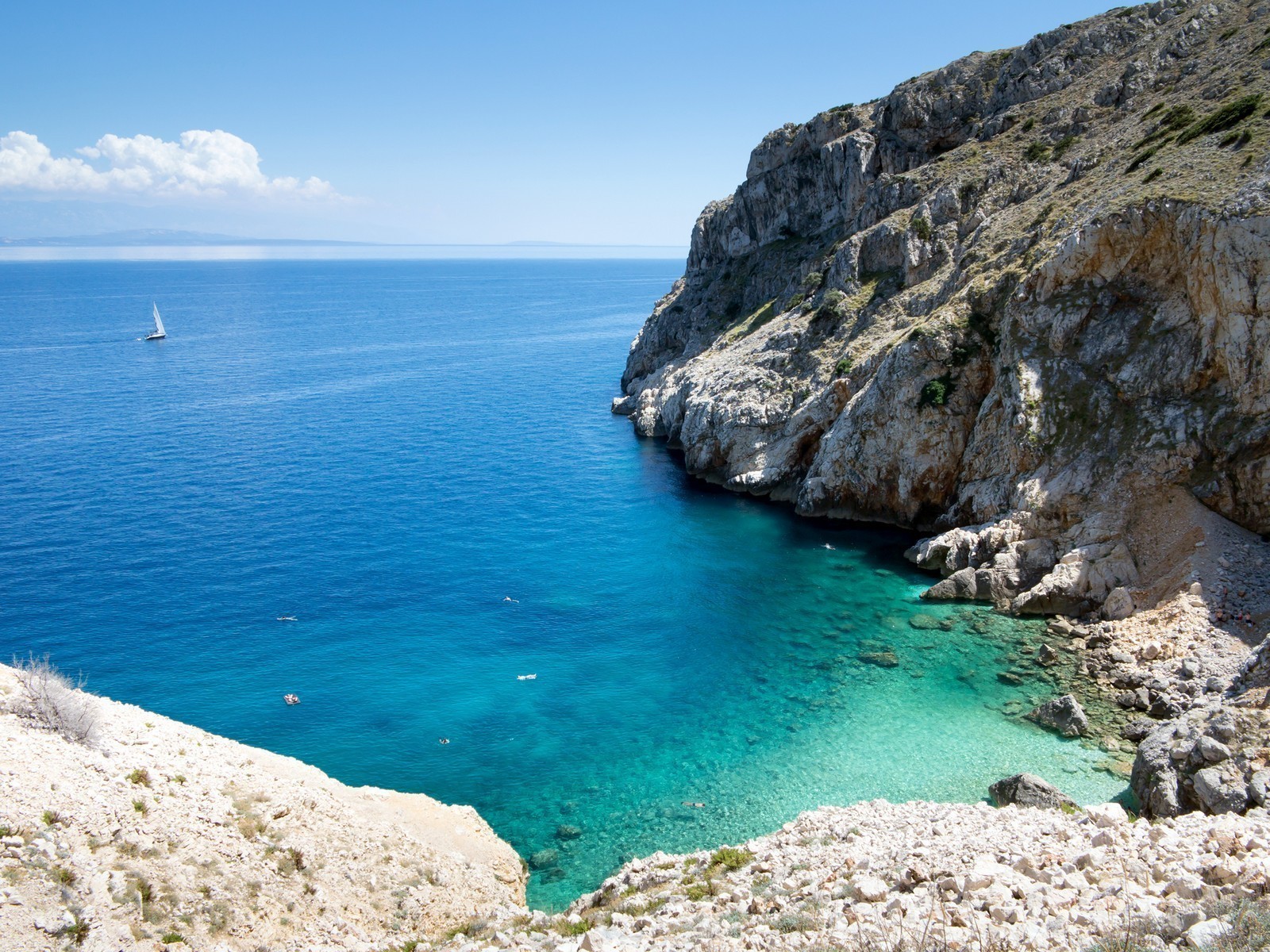
An island in the western group of the Kvarner islands. It is the second largest island on the Adriatic after Krk. The largest of the bays on the eastern, not very rugged coast, is Koromacna, while larger bays on the western coast include Creski zaliu, Valun, Martinscica and Ustrine. There are noticeable differences in temperature and precipitation between the northern and eastern sides on the one hand, and the western side on the other. There are several preserved forests in the northern part, while they are quite rare in the southern part. The greatest concentration of settlements is on the western side, while they are significantly less numerous on the eastern side. Part of the steep eastern coast was declared an ornithological reserve in 1986. There are nests of the griffon vulture (Gyps fulvus) on the inaccessible rocks and reefs. These birds are a natural sanitary service, since they feed on sheep carcasses.
The main settlement of the island is the town of Cres. The most important traffic connection is the road from Porozina in the north across Osor to Veli Losinj. A railway drawbridge across a narrow artificial canal connects the islands of Cres and Losinj. Ferry lines connect the island of Cres with the mainland (Brestova-Porozina) and the island of Krk (Valbiska-Merag). The remains of prehistoric settlements have been discovered on Cres. In antiquity, Cres and Losinj were called by the common name of Apsirtides, and the settlements of Krepsa (Cres) and Apsnros (Osor) were mentioned. After the Romans, the island was ruled by the Byzantines. Afterwards it was gradually settled by the Slavs. From 1000 to 1358, the island was under Venetian rule. After that it was ruled by the Croatian and Hungarian kings, and then by Venice again between 1409 and 1797. Until 1918 it belonged to Austria, between 1918 and 1945 to Italy and Germany, and since 1945 it has been part of Croatia.
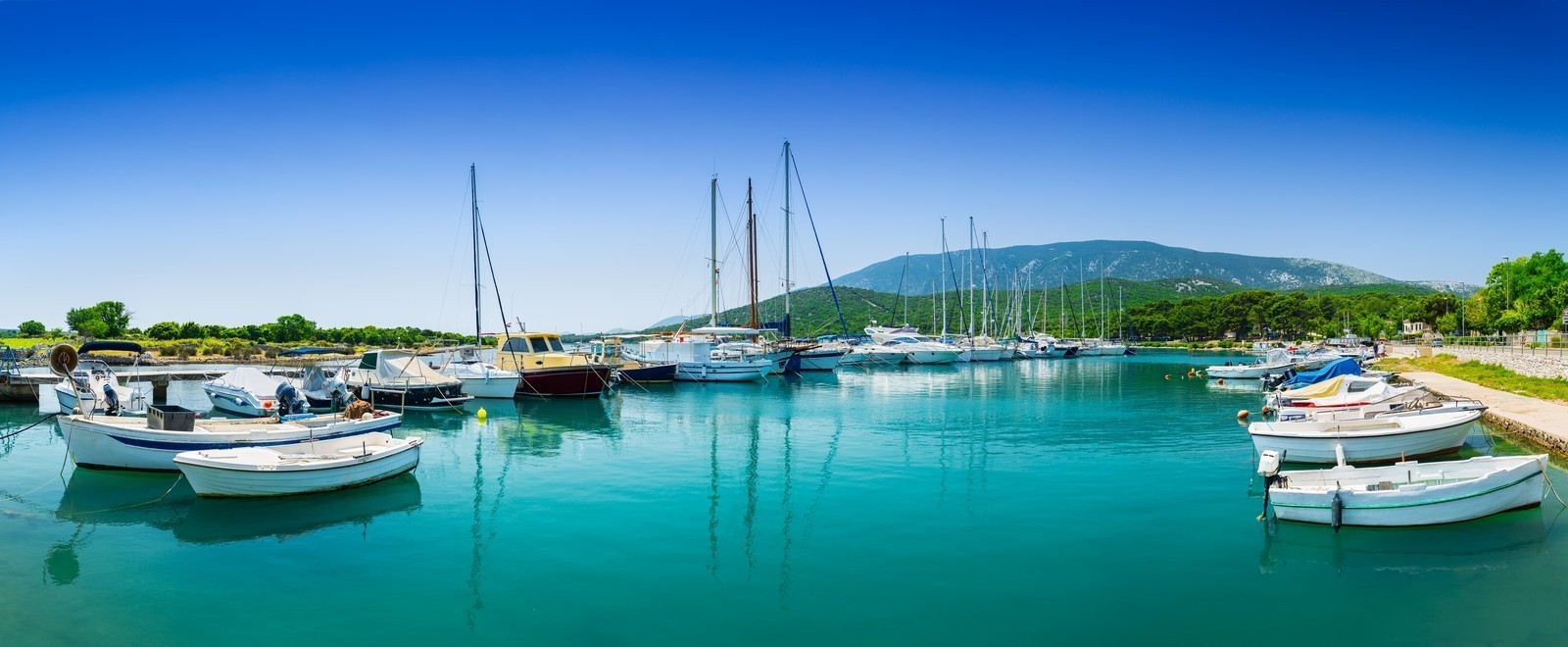
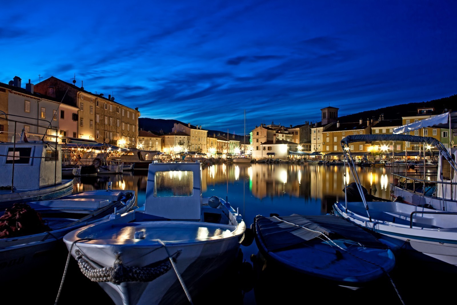
CRES TOWN - A town on a well-protected bay on the western coast of the island, situated along the main road between Porozina and Veli Losinj. Cres is the administrative, cultural, economic and tourist centre of the island, and a major factor in the development of tourism. Due to its wide bay with beaches and a marina, its tight row of houses in the historical core, and its propitious micro-climate, it is one of the most beautiful towns on the Adriatic. It supposedly developed on the site of the Roman settlement of Crepsa. In the Middle Ages, it was surrounded by a wall. It was granted a town charter in 1332. In 1459, it became the seat of the Venetian administration for the islands of Cres and Losinj. It remained within the wall until the end of Venetian rule. In the 20th century, the wall slowly began to be removed in order to allow the town to expand.
Tourism began to develop after World War II, particularly when the Kimen Hotel was built. In the middle of the 19th century, Cres was one of the most important maritime centres on the Adriatic, and had its own shipyard which is still operational. The town has numerous historical monuments, such as parts of the wall with a round defence tower, the double town gate, the town loggia, the Parish Church of sv. Marija (St. Mary) from the 15th century, the Romanesque Church of sv. Izidor (St. Isidore) with a gothic facade, the Arsan Palace from the 15th century, which houses the town museum, the Church of sv. Marija Magdalena (St. Mary Magdalene) from 1402 and the Franciscan monastery.
Boats can berth at the quay or the pier at a depth of up to 4.5 m, but they are usually occupied by fishing boats and tourist vessels. It is best to drop the anchor and tie up to the breakwater stem-to. Behind the breakwater, there are two inner harbors full of local boats, so there is no space for mooring. The port is protected from all winds, only a strong jugo can cause waves. The best anchorage is located between the shipyard and the marina. There are a few berths in the area of the shipyard. The depth of the sea at the pier is 5 m. ACI Cres Marina (051) 571-622 - There are 445 berths at a depth of 6 m, 30 spaces for dry storage, a repair shop, a 10 ton lift, and a 30-ton movable lift.
LUBENICE - A small settlement with a population of 40 on the central part of the island of Cres. It sits on a 378 m high rocky peak above the sea. It is accessible by a local road or a steep trail that leads from the sandy beach. Lubenice is one of the oldest settlements on the island. On one side, it is protected by inaccessible cliffs, on the other by a wall, whose eastern part can still be seen. It was once a fortified observation point. Its former importance is evident from its four churches.
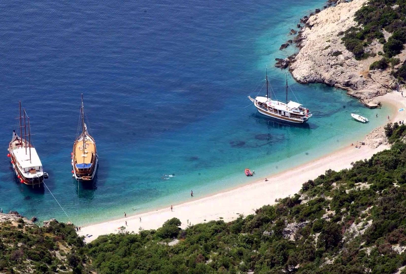
MARTINSCICA - A small picturesque settlement on a bay of the same name on the western coast of the island. Along with Cres, it is the only important coastal settlement. It is known for its 500m long sandy beach. Its attractions include the Church of St. Martin from the 19th century, the monastery with the Church of sv. Jeronim (St. Jerome) from around 1500, and a country mansion from the 17th century. The bay is exposed only to southerly winds. Boats can tie up at the head of the pier or stem-to on the inner side of the pier. There are two large berths on the left and right side of the pier. Behind the breakwater on the southern side of the bay lies a small harbor which is usually occupied. Anchorage is available within the port, but the rocks at the bottom do not provide a good hold. Facilities include a lift and a launch ramp.
OSOR - The oldest settlement on the islands of Cres and Losinj. It is situated along an ancient narrow artificial canal, which is spanned by a drawbridge that connects the Osor Bay in the north with the Losinj Channel in the south. Once the hub of the island routes, Osor is now a peaceful town/museum with numerous monuments of the past, and it hosts summer musical evenings and a permanent exhibition called Sculpture and Music. The streets are lined with sculptures created by famous artists. In the oldest sources, the settlement is called Apsoros. In the Roman era, Osor (Apsorus) was a municipal and a very important commercial center with a port. From the 9th century on, it was the seat of a diocese. Around 1000 it was occupied by the Venetian Republic. In 1450, the prince moved the administration to Cres, and Osor's development ceased, even though the diocese with the cathedral, which was finished between 1463 and 1484, remained. There are numerous attractions in Osor.
The remains of the town wall and the foundations of temples and public buildings with mosaics have been preserved from antiquity. On the town square in the middle of the settlement stand the Cathedral of sv. Marija (St. Mary) and the Church of sv. Gavdencij (St. Gaudentius), both from the 15th century, as well as the parsonage and the town hall, which houses an archaeological collection. The remains of a Franciscan monastery lie in the Bijar Bay next to the Church of sv. Marija (St. Mary) from 1414.
The canal is 11 m wide and around 2.5 m deep. The passage beneath the lowered bridge is 1.5 m high. The bridge is raised twice a day. Boats coming in from the south have the right of passage, and they have to pass in single file. Berths are available on the northern side of the canal at the 50-m-long quay at a depth between 3.5 and 4 m. On the southern side, there is only space for 2 boats. When landing or navigating through the canal, the powerful currents with a speed of up to 5 knots need to be taken into account. The northern side is exposed to northerly winds. When they blow, boats have to be moved to the Bijar Bay. The southern side is exposed to southerly winds. When they blow, boats have to be moved to the Sonte or Kaldonta Bays. There is a small lift and a launch ramp on the southern side. BIJAR - This bay provides an excellent anchorage when the bora blows. There are a few berths at the quay. When the bora blows, it is advisable to use the berths in the northern part of the bay, which is protected from all winds.
POROZINA - A small settlement with a ferry landing for the mainland (Brestova) on the northwestern coast of the island of Cres. On a hill above the landing stand the Church of sv. Nikola (St. Nicholas) from the 15th century and the ruins of a Franciscan monastery. The landing is protected from all winds except the westerly and southwesterly. There is a small harbor behind the ferry landing, but it is usually occupied. Berthing is only possible with permission of the owner of the berth.
PUNTA KRIZA - A small fishing village on the southeastern part of the island of Cres. The wooded area boasts a wealth of flora and fauna. The protected bays on the very rugged coast offer secluded sandy beaches and safe anchorage. The very rugged coast extends from the Toverascica Bay in the northeastern part to the Kaldonta Bay in the southwestern part. The bays which line the coast are narrow and shallow and their bottom is sandy. There are shoals and reefs in front of them. The bays provide good shelter from the wind.
TOVERASCICA - This bay is exposed to the bora along with the neighboring Zaklopica, Vela Javorna and Mala Javorna Bays. The depth of the sea is around 5 m. There is a concrete pier in Vela Javorna. In this bay lies the harbor of the settlement of Punta Kriza. Pay attention to a large shoal before the bay. The neighboring bays of Majiska and Kolorat are the most sailor-friendly bays in the area. From Sv. Damjan Cape onwards, there is a series of sandy bays which open to the south and are well-protected from the bora. The Meli Bay with a pebbly bottom can only be entered during high tide. The middle of the Baldarin Bay provides a good anchorage at a depth of 4.5 m. The Jadrisnica Bay cuts deep into the mainland. This narrow and long bay is exposed only to southeasterly winds. One arm of the bay is surrounded by the houses of the former fishing village of Pogana, which have been turned into vacation cottages. The small pier is protected even from the jugo, but the bay can be uncomfortable when the jugo blows. There is a naturist camp on the eastern coast.
VALUN - A picturesque fishing village on the western coast of Cres in the southern part of the Valun Bay. It developed into a small, pleasant tourist settlement when the road was built. The large sandy beach with a small campsite is very popular. In the middle of the village stands an inn with a former olive oil mill. The sacristy of the parish church contains the Valun Tablet from the ir century, possibly the oldest Glagolitic monument in Croatia. It testifies to the fact that these parts were inhabited by the Croats as well as the old Romance inhabitants. There are berths for local boats behind a small breakwater, so mooring is only available by prior arrangement. Due to the lack of space at the quay, where the sea is 2 m deep, it is necessary to tie up stern-to, and drop the anchor from the bow. The sea is much deeper in other parts and requires a long anchor chain. In front of the inn, there are around 10 buoys for small boats, which tie up to the shore stern-to. The bay is exposed only to the bora, so it is not advisable to linger there when it blows.
VRANSKO JEZERO (LAKE VRANA) - This fresh-water lake in the central area of Cres is 5.8 km2 large. Its surface lies at an altitude of around 13 m, while the bottom lies around 68 m below sea level (cryptodepression). The lake is a large natural reservoir of exceptionally clean drinking water for the islands of Cres and Losinj. It is fed by rain water and underground karst springs. It is a strictly protected reserve and access to the lake is forbidden. There are freshwater fish in the lake.
We are very social bunch. Get in touch!