We use cookies, along with some third-party sites (like Google, Facebook, etc.). By continuing to visit this site you agree to our use of cookies.


- Search Yachts
- Destinations
- Company
- Sailing info
- Blog
Need help? Contact us

A peninsula in Southern Dalmatia between the Neretva and Mali Ston Channels to the northeast and the Mljet Channel to the southwest. The highest peak of this mountainous region is Sveti Iija (960 m). The entire northern coast is exposed to the bora, s well as the jugo that blows into the Neretva Channel from the east. The southern side is exposed to the maestral and the jugo. Surface streams are infrequent and short. The large settlements are mainly located in the interior, but the largest one, Orebic, is coastal port town. The historically important settlements of ton and Mali Ston lie at the beginning of the peninsula, where joins the mainland. The settlements on the peninsula are linked by a regional road. The Peljesac Peninsula is known for its vineyards and the Plavac grape variety which produces a wine called Dingac. Other important economic activities include salt production in the Ston Channel, olive groves, fishing, clam farming and tourism. Ferry lines connect the peninsula with Ploce (Trpanj) and the island of Korcula (Orebic).
After the Roman era, which left numerous traces in Orebic, Ston, Janjina and other places, the peninsula was taken over by the Byzantines, followed by the Neretvans (Neretljani) and the Zahumlje Principality. Between 1333 and 1613 it was ruled by le Dubrovnik Republic, which built some of the largest fortifications on the eastern Adriatic coast in Ston. The flourishing economy in the 17th century was brought about by local ship builders.
KUCISTE - A settlement on the Peljesac Channel west of Orebic, at the foot of a hill which protects it from the bora. The beach lies to the east in the settlement of Zamosce, where the remains of a Roman holiday mansion have been discovered. The core of the settlement dates back to the 16th century. The so-called captains' houses, which were built later, were modelled on the summer mansions of Dubrovnik. In 1640, the Venetian cartographer Vicenzo Mario Coronelli marked his 30 houses in Kuciste on his maps. The Church of sv.Trojstvo (the Holy Trinity) from 1752 is one of the most important Baroque churches on the southern Dalmatian coast. There are several small piers in front of the houses. The main pier with a depth of 3 m lies in the middle. The harbour is exposed to southerly winds and a strong NW wind can create major problems.
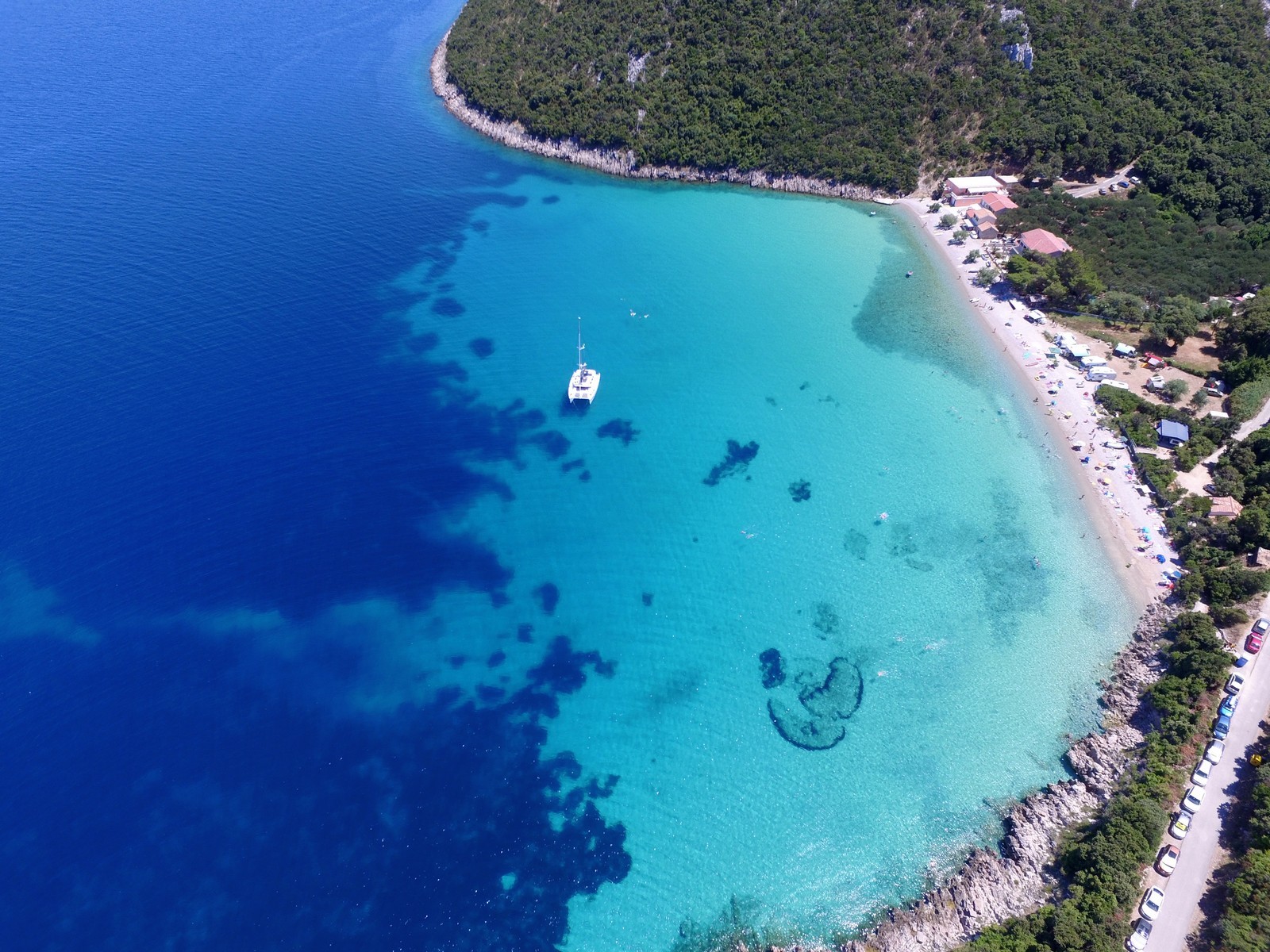
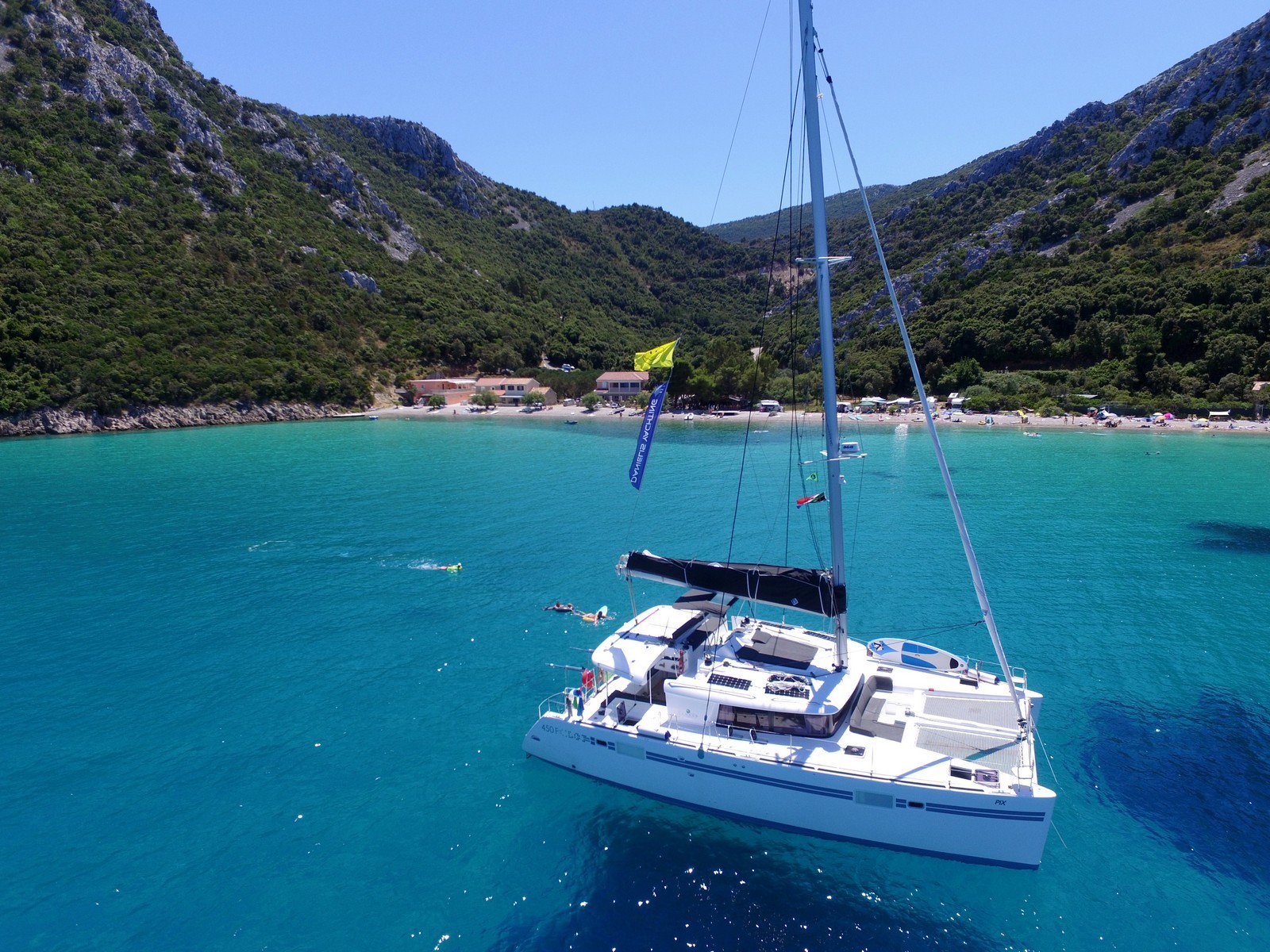
LOVISTE - A small new tourist settlement on the Luka Bay on the north-westernmost part of the peninsula. It lies at the end of the regional road. The main economic activities are agriculture, wine and fruit growing, fishing and tourism. The settlement has the largest drying house for figs and carobs in Croatia. The whole settlement is covered with gardens. Part of the large beach is reserved for naturists. The most prominent of the numerous small bays in the vicinity is Mirce with its white sandy bottom. The Luka Bay is protected from all winds and provides a good anchorage. Berths are available at a pier with a depth of 3 m. Anchoring in the eastern part of the bay is prohibited due to underwater cable lines.
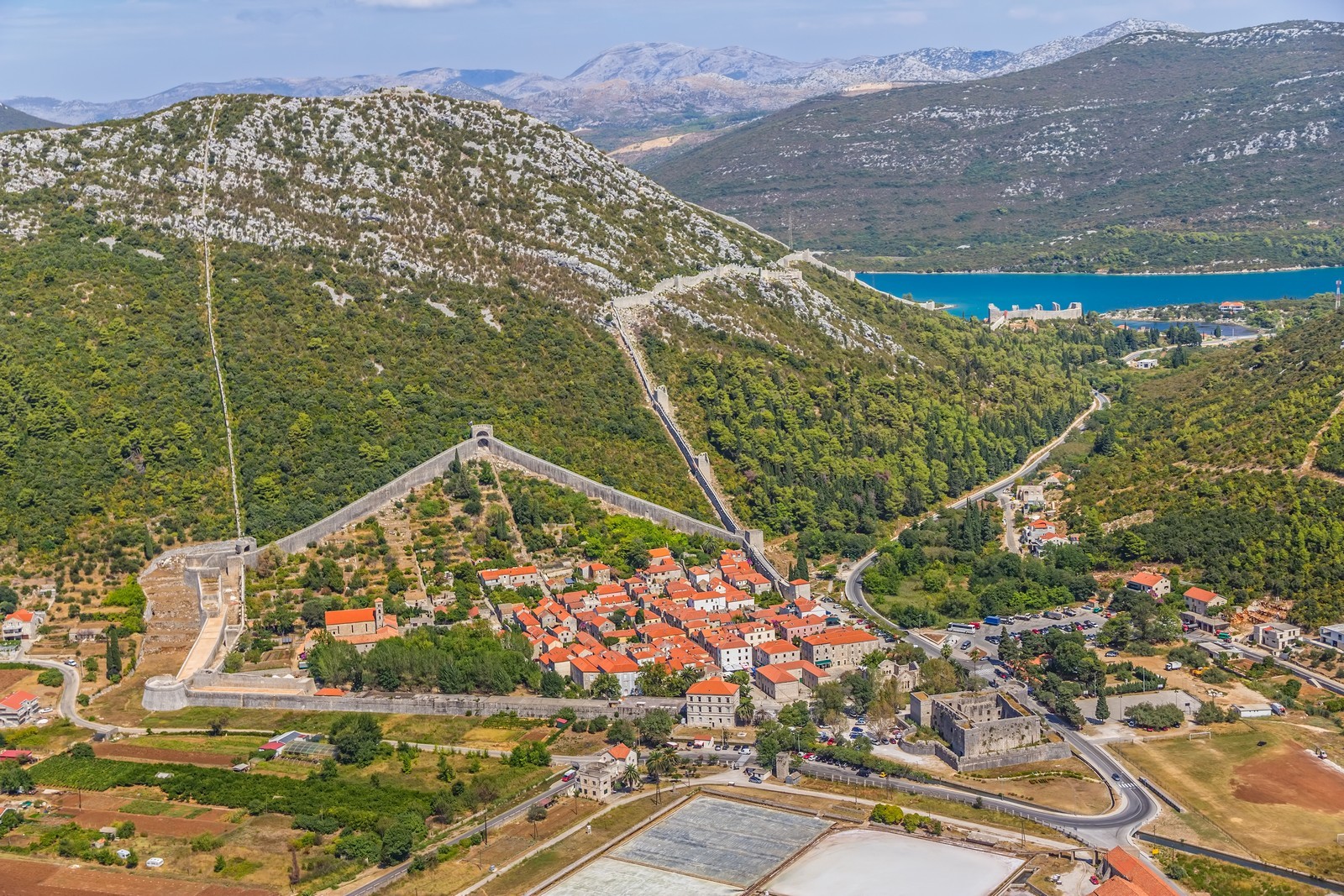
MALI STON - A settlement with a harbour on the Mali Ston Channel only 1 km from Ston. It was established in 1334 by the inhabitants of Dubrovnik, who surrounded it by walls in the shape of a square between 1336 and 1347. On the southern side stands the Koruna Fortress with five defence towers. A wall called Veliki zid (the Great Wall) leads from the fortress to the town of Ston with a section branching off to the Pozvizd peak with a fortress of the same name, which affords a magnificent view. The Mali Ston port from 1490 was modeled on the port of Dubrovnik. A church from the middle of the 14th century with a bell from 1419 stands in the middle of the settlement and has been reconstructed several times. The harbor is protected from all winds and provides a good anchorage for small boats. Due to its shallow depth, the only suitable berths are available by the round tower at a depth of 3 m. The harbor is protected from the bora by a 40 m long breakwater.
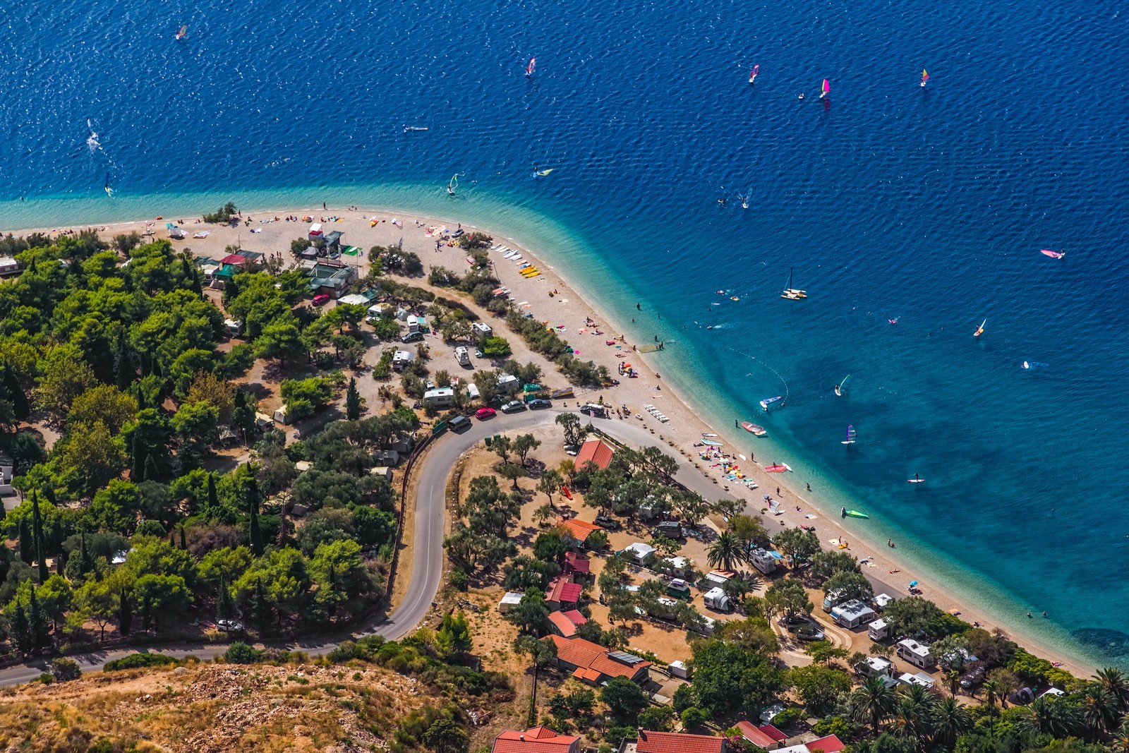
OREBIC - A town with a ferry landing (Korcula) on the Peljesac Channel on the southern coast of the peninsula, on the regional road. The main economic activities are agriculture, fruit growing, fishing and tourism. Orebic is an important tourist town with diverse accommodation facilities, restaurants and sports and recreation facilities. The most beautiful beaches, including a few naturist beaches, can be found in the wide Trstenica Bay. There are several private campsites in the area. The town features a maritime museum. Until the 16th century, the town was called Trstenica and was the rector's seat under the administration of Dubrovnik (1343-1806). Orebic was a town of sea captains and was named after one of the captains' families.
The Peljesac Maritime Company, established in 1865, had 33 ocean-going sailing ships but its star faded with the onset of the steam era. Numerous architecturally interesting captains' houses testify to the heyday of Orebic. Other attractions include a Franciscan monastery from the 15,h century to the west, and a Gothic church reconstructed in the Baroque style with ancient sarcophagi and an old protected cypress forest on an elevation above the monastery. Sveti llija (960 m), the highest peak on the peninsula, affords a breathtaking view of the southern Adriatic. In the harbour, there are 30 berths at a depth of 3 m on the inner side of the breakwater. The ferry lands at the part of the breakwater which lies outside the marina. Lucica Orebic (020) 713 241 - The harbour of a sailing club next to the ferry landing is also open to boats that do not belong to the club. There are 220 berths, 20 spaces for dry storage, a 3,5-ton lift and a launch ramp. The depth of the sea is up to 4 m.
POTOMJE - A settlement in the interior of the peninsula on the regional road on the western edge of the Dingac wine-growing region. A slope called Dingac is planted with an indigenous grape variety called Plavac mali crni which produces Dingac, a high-quality strong dry red wine with a 14% alcohol content and a controlled geographical origin. A tunnel was built between the settlement and the coastal road for easy access to the hamlets of Potocine and Borak which have developed into attractive bathing spots.
STON - A town with a port on an isthmus which connects the Peljesac Peninsula with the mainland. The Ston Channel connects the port of Ston with the open sea. The town's economy is based on agriculture, wine and olive growing, fishing, clam farming and tourism, but the main economic activity has always been salt production. The coast along the town, the Ston Channel and the Prapratna Bay 3 km away is ideal for swimming, fishing and underwater fishing. The historical settlement of Ston with its famous wall and numerous cultural monuments is an extraordinary example of a fortified town and of Dubrovnik architecture. Near the village of Cesvinica in the vicinity of Ston lies the Gudnja Cave, a rich archaeological site from the Neolithic period. No particular rule was firmly established in this area until the 14th century. Ston began to develop in 1333, when the Peljesac Peninsula became the property of Dubrovnik. The inhabitants of Dubrovnik established large saltpans and built a settlement with a grid-shaped street layout. The town is surrounded by a well-preserved 980m long defence wall in the shape of an irregular pentagon. Through the centuries, Ston was second only to Dubrovnik in terms of its importance, and its cultural heritage is very valuable. In addition to the town as a whole, other points of interest include the 5 km long defence wall between Ston and Mali Ston with 20 towers (of the original 40) and 7 fortresses.
The principal parts of the system are the Veliki kastio Fortress in Ston, the Koruna Fortress in Mali Ston and the fortress on the Pozvizd hill. Ston's school was mentioned in 1389, the almshouse in 1458 (the building has been preserved) and the orphanage in 1494. A water supply and sewage system was established as early as 1581. The most prominent secular buildings are the Gothic-Renaissance administrative seat of the Dubrovnik Republic, the Sorkocevic Palace and the former bishop's palace from 1573, and the Renaissance Rector's Palace which was reconstructed in the W century. The Franciscan monastery with a Late Romanesque church dates back to 1347. On the Gradac hill to the southwest stands the magnificent pre-Romanesque Church of sv. Mihajlo (St. Michael) with valuable remains of frescoes from the end of the 11th or the beginning of the 12th century. Access to Ston from the sea (the Ston Channel) is difficult, because the navigable channel is only 25 m wide and 2.5 m deep. Navigation is not recommended when the jugo blows. Boats can berth at the quay at a depth of 4 m or at the small pier. The harbor is exposed to southeasterly winds.
TRPANJ - A large tourist town with a port on the Neretva Channel on the northern coast of the peninsula. Its economy is based on water sources, agriculture, fishing and fish processing. The picturesque beaches are surrounded by pine forests. There are numerous vacation cottages on the coast. A ferry line connects the town with the mainland (Ploce). The present town centre was built around 1500, when the area was under Dubrovnik administration. On a hill above the town lie the ruins of a medieval fortress. In the middle of the town stands the Church of Our Lady of Karmen with a Renaissance high altar. The port is protected by a very long breakwater built on an outcrop and a knee-shaped pier surrounded by shallow sea. Boats can berth at a depth of 2 m at the beginning of the breakwater, which is not connected with the coast. The ferry lands at the central pier. The main town beach lies in the Luka Bay.
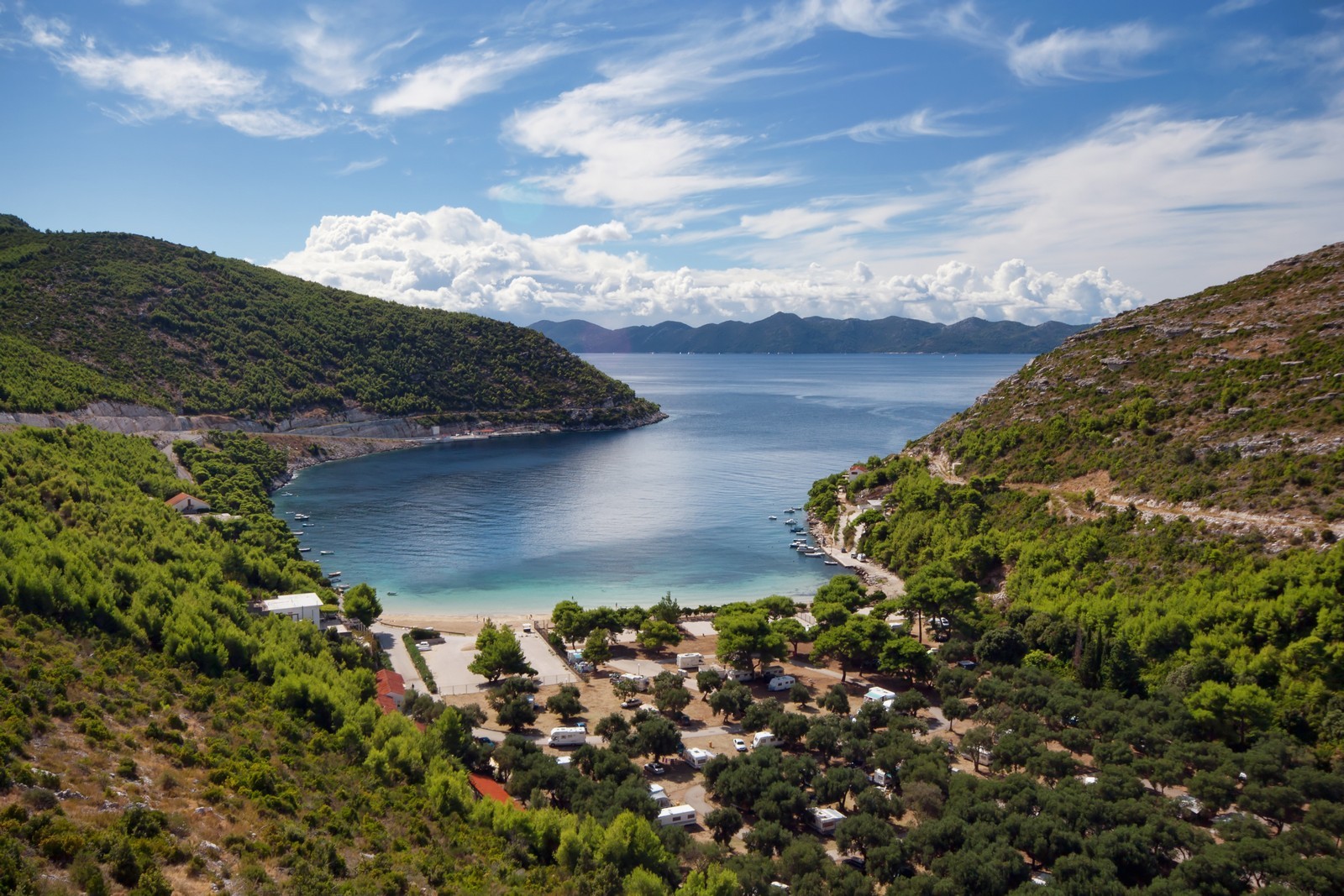
TRSTENIK - A settlement with a port on the central part of the southern coast of the peninsula. In addition to wine growing (high-quality Dingac wine), its inhabitants engage in fishing and tourism. Wine growing was also responsible for the development of the port. The largest port on the southern side of the peninsula is protected from the jugo by a breakwater, which together with the surrounding hills also protects the port from other winds. The depth of the sea at its head is 5 m. During the summer, the end of the breakwater is reserved for a water tanker. Berths are also available at the 100-m-long quay next to the breakwater.
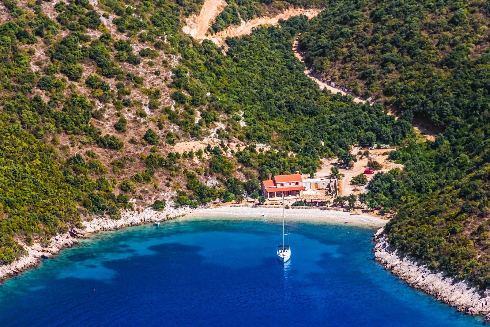
VIGANJ - A settlement with a harbour on the Peljesac Channel on the western part of the southern coast of Peljesac. It is protected from northerly winds, which furthers the growth of interesting plants which were brought back by local sailors from their voyages across the oceans. The settlement has the appearance of an orchard and botanical garden. There are several private campsites and houses for rent in the settlement and a wide pebbly beach on the coast. The Dominican monastery with a church was built in 1671. The Gothic Parish Church of sv. Mihovil (St. Michael) was reconstructed in the Baroque style in 1760. The harbour has a pier with a depth of 3 m and a quay with a depth of up to 1.5 m. It is exposed to southerly and westerly winds.
ZULJANA - A settlement with a harbour on a wide bay of the same name on the southern coast of the peninsula. It is characterised by rural architecture. The entire bay is one huge pebbly beach, one of the largest on the Adriatic. There are several private campsites in the settlement. The Baroque Church of St. Martin stands on the foundations of a medieval church. Next to it stands the Chapel of sv. Nikola (St. Nicholas) from 1630. The Church of sv. Julijana (St. Juliana) is a Renaissance-Baroque structure with a bell gable. Great care is needed when entering the harbour due to several shoals and reefs in the bay. A lighthouse enables safe landing at night. Berths are available at the pier which is frequently occupied by local boats. There is an anchorage in front of the beach in the middle of the bay at a depth of 6 m. The relief of the narrow part of the peninsula does not prevent the bora from blowing in the bay.

We are very social bunch. Get in touch!