We use cookies, along with some third-party sites (like Google, Facebook, etc.). By continuing to visit this site you agree to our use of cookies.


- Search Yachts
- Destinations
- Company
- Sailing info
- Blog
Need help? Contact us

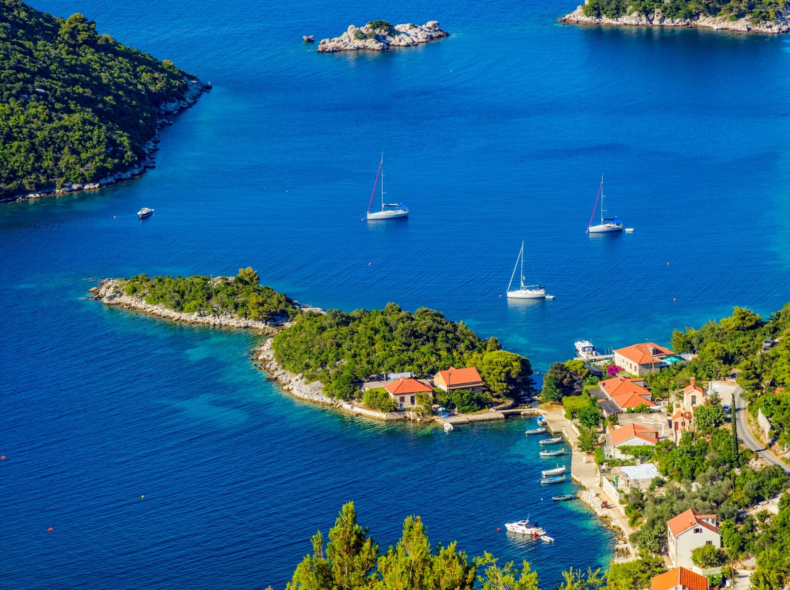
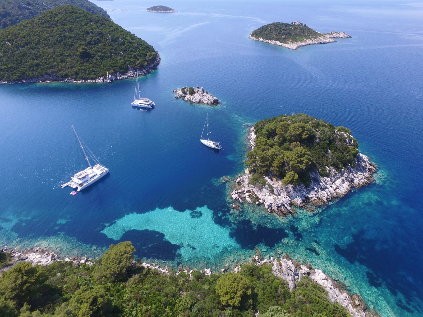
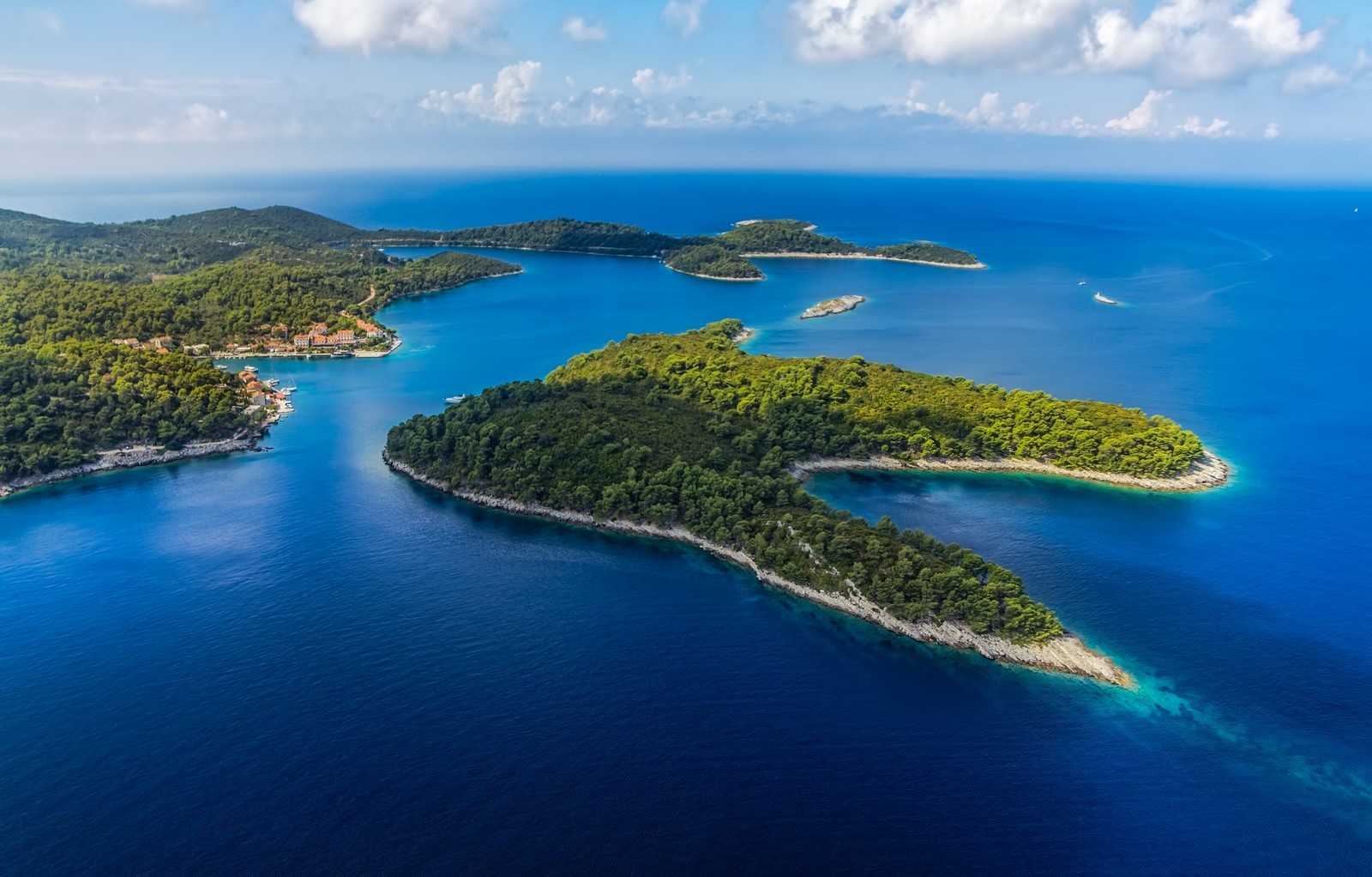
Mljet belongs in the Southern Dalmatian island group and is the eighth largest island on the Adriatic. Its highest point is Veliki Grad (513 m). Its karstic hills are interspersed with fertile karstic plains. Due to the warm summers and mild winters, the island is covered with diverse Mediterranean vegetation. 72% of the island is covered with forests, which makes Mljet one of the most wooded islands on the Adriatic. The land animals were decimated by mongooses which were brought to the island intentionally to destroy the snakes, but have killed much of the other wildlife as well. The coast is fairly rugged, particularly in the north. Larger bays include Pomena, Polace, Tatinica, Sobra, Prozura, Okuklje and Saplunara.
The coastal belt is the home of the protected Adriatic seal (medvjedica, Monachus albiventer),which is a rare species. There are several uninhabited islets and reefs in front of the western, northwestern and southeastern coasts. The main settlements lie on fertile plains in the interior. The largest one is Babino Polje. The main economic activities are agriculture, wine growing, olive and medicinal herb growing, fishing and tourism. In recent times, the hamlets on the coast which were used as harbors for inland settlements have developed into small tourist settlements. All the larger settlements are connected by bus routes.
The island of Mljet was settled in prehistoric times (remains of lllyrian settlements). In 35 B.C. it came under Roman rule, in the 10th century it was ruled by the Neretvans (Neretljani) and in the 11th century it became part of the Zahumlje principality. In the 12th century it was given as a gift to the Benedictines from the Italian town of Pulsano (Monte Gargano). Between 1345 and 1818 it was ruled by the Dubrovnik rectors and afterwards it followed the fate of the other Dalmatian islands.
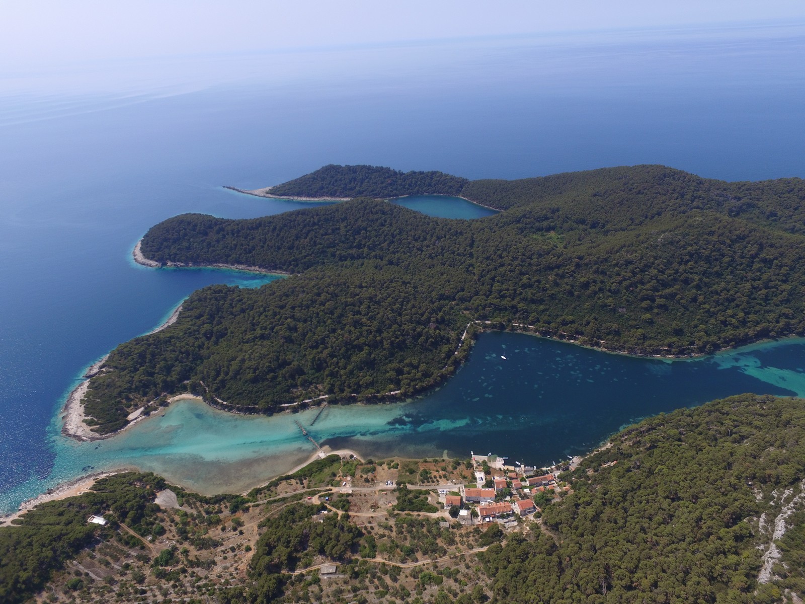
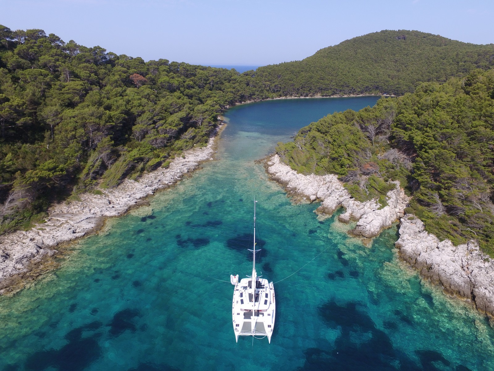
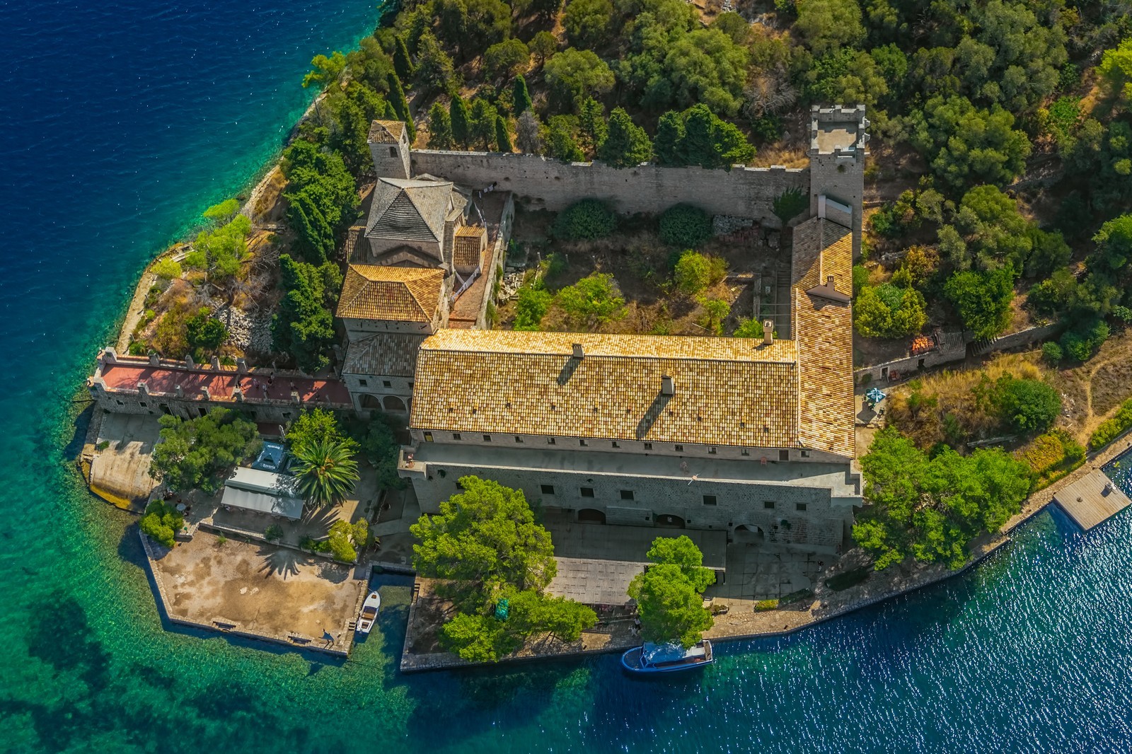
NACIONALNI PARK MLJET - The western part of the island is characteristically rugged. Its lush vegetation, diverse fauna and valuable cultural heritage were the bases of the decision to declare a third of the island a national park in 1960. The park encompasses Veliko jezero (Large Lake), Malo jezero (Small Lake), the Soline Bay, a stretch of sea that extends 500 m from the most protruding capes with the corresponding islets, and the settlements of Polace, Pomena and Govedari. Both lakes are connected with each other and with the sea by two narrow artificial canals. The tide creates a strong sea-water current which was once used to power mills. Veliko jezero covers an area of 145 hectares and is up to 46 m deep. In the southern part lies the island of Sveta Marija with a Benedictine monastery from the 12th century. Malo jezero covers an area of 24 hectares and is up to 29.5 m deep. Due to the sluggish circulation of water between the two lakes, the summer temperatures of Malo jezero are 3 to 4 degrees higher than the temperatures of the sea, while its winter temperatures are up to 8 degrees lower. Both lakes abound in clams. Navigation on the lakes is prohibited, but tours are available on the National Park boats.
OKUKLJE - A settlement with a harbour on a bay of the same name on the northeastern coast of Mljet. In the middle of the 17th century the settlement was abandoned due to incessant pirate attacks, so there are no old houses. The bay offers one of the best shelters from the winds on the island. There is a wide harbour with a depth of 3.5 m along the coast. Anchorage can also be found within the bay at a depth of 5 m, but the sandy bottom does not provide a good grip. When entering the bay, care should be taken to avoid the marked shoals in the southern part.
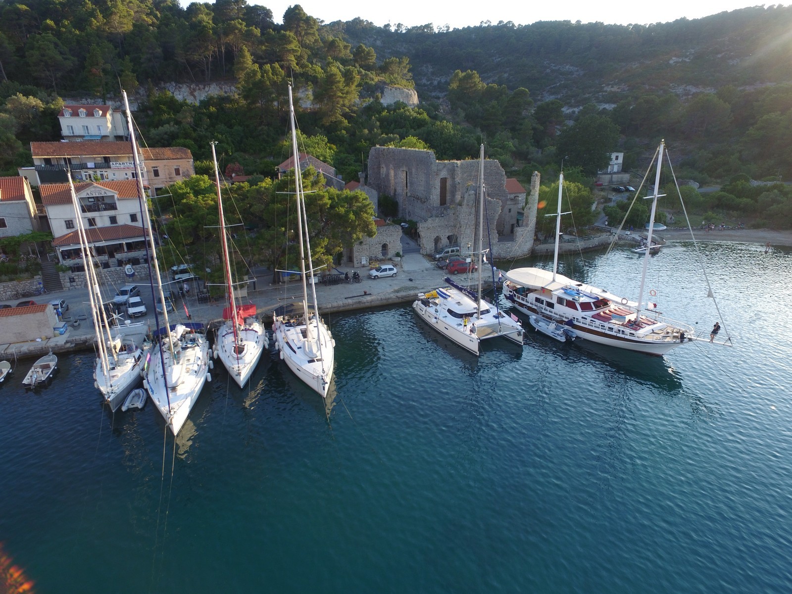
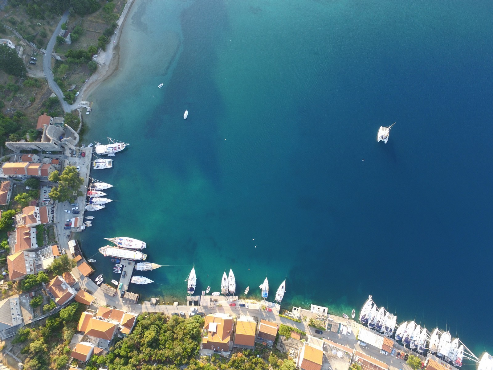
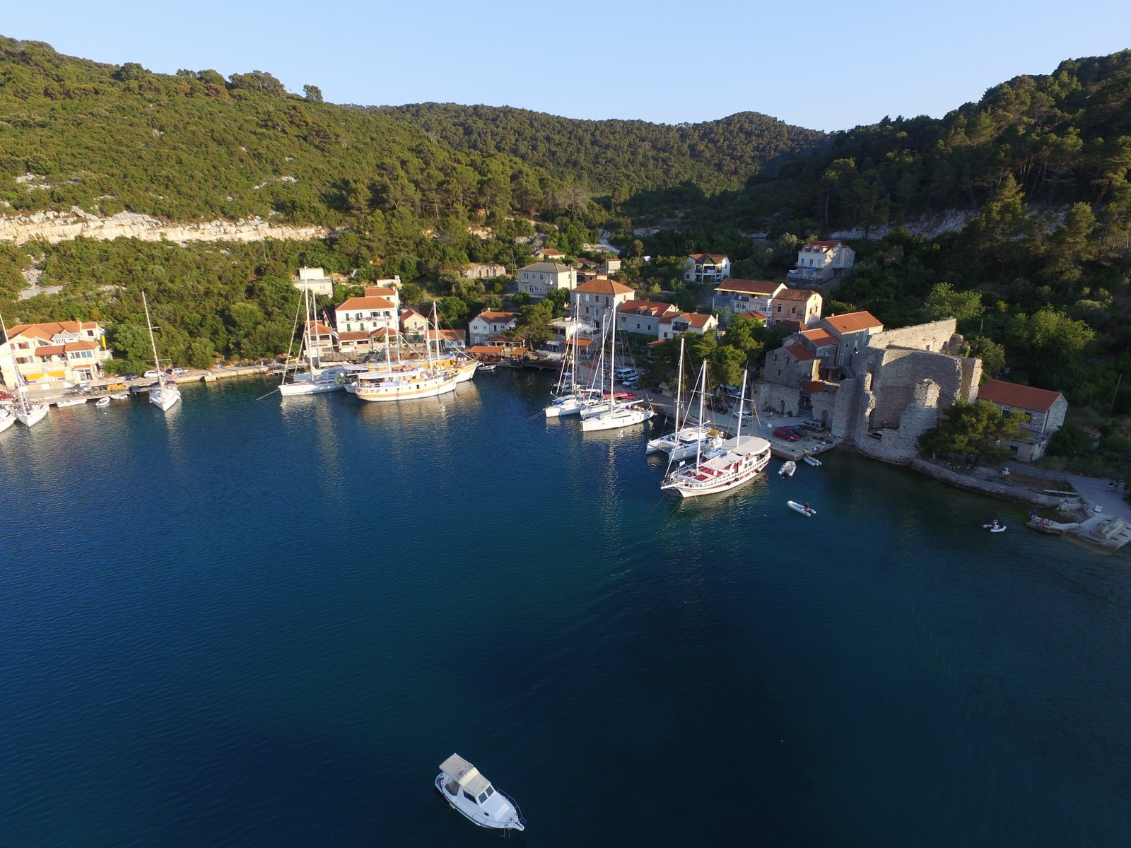
POLACE - A settlement on a bay of the same name on the northwestern part of the island of Mljet on the regional island road. There is a natural spring. The bay is the largest on the island and is protected from the winds by a group of islets. Due to the favourable sailing conditions and its location within the national park, the settlement is popular with day-trippers and seafarers. There are several remains of buildings from the 1st to the 4th century in Polace, the most important of which is a monumental palace with two towers (one of them has been preserved to a height of 20 m). On a knoll above Polace lie the ruins of a fortification from late antiquity. The ruins of an Early Christian basilica and the well-preserved remains of a 5th century church lie nearby. Since the ferry landing was moved to Sobra, there has been enough space for berthing at the quay with a pier, but only along the central part at a depth of 1.5 m. The depth of the sea at the pier is 5 m. There are also a few mooring buoys. The safest anchorage is located in the northwesternmost part of the bay at depths between 12 and 15 m. The bay is surrounded by a forest that reaches all the way to the coast.
POMENA - A settlement with a harbour on the western side of the island in the national park. Once the anchorage of fishermen from Govedari, the settlement is now the centre of tourism on the island with a hotel, a campsite and numerous sports and recreational facilities. There is a naturist beach on the islet of Pomestak. The harbour has a long quay intended for tourist ships and passenger ships that transport guests of the modern hotel complex. A great deal of care is required for safe navigation in the harbour and navigation charts should always be consulted. Night-time navigation is not advisable, because there is no lighthouse on the coast. Boats can berth at a quay with a depth of 2.5 m or in front of the hotel, where a few mooring buoys are available. Part of the quay is equipped with water and electricity hook-ups. The bora blows strong in the harbour and if the boat is moored alongside the quay, it may not be able to set off. Anchorage is available behind the islet of Pomesak or in the Lokva Bay.
PROZURA - A settlement on a bay of the same name on the eastern part of the island. This modern tourist settlement hugs the bay with a sandy beach which is one of the loveliest on the island and is surrounded by a pine forest. The sandy beach in the nearby Blaca Bay is very popular in the summer. Alongside the road to the settlement of Korita lies the Pinjevci fallow with a picturesque stone pine forest. The Saplunara Bay is the only safe shelter from the jugo on the southern side of Mljet. The northwestern part of the bay along the new houses is also completely safe from the bora.
SOBRA - A settlement with a ferry port on the northern coats of Mljet and the harbour of Babino Polje, the largest settlement on the island. When a ferry landing was established in Sobra, it became the most important settlement on the island. It has only been permanently settled since the second half of the 19th century, so there are practically no old houses, and the new ones were mainly built for tourist purposes. The island is connected with the mainland and the neighbouring island of Sipan by the local ferry lines to Dubrovnik and Sudurad and the international Rijeka-Zadar-Split-Stari Grad-Korcula-Sobra-Dubrovnik-Bari ferry line. In the hinterland lies the Blatina Marsh with an eel farm. Nearby lies the Omani spring, where a water supply system begins. Berths are available at a quay with a depth of 4 m or at the ferry landing, if it is not occupied. The harbour is partially exposed to northeasterly winds which can be avoided by moving the boat.

We are very social bunch. Get in touch!