We use cookies, along with some third-party sites (like Google, Facebook, etc.). By continuing to visit this site you agree to our use of cookies.


- Search Yachts
- Destinations
- Company
- Sailing info
- Blog
Need help? Contact us
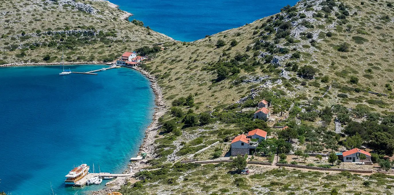
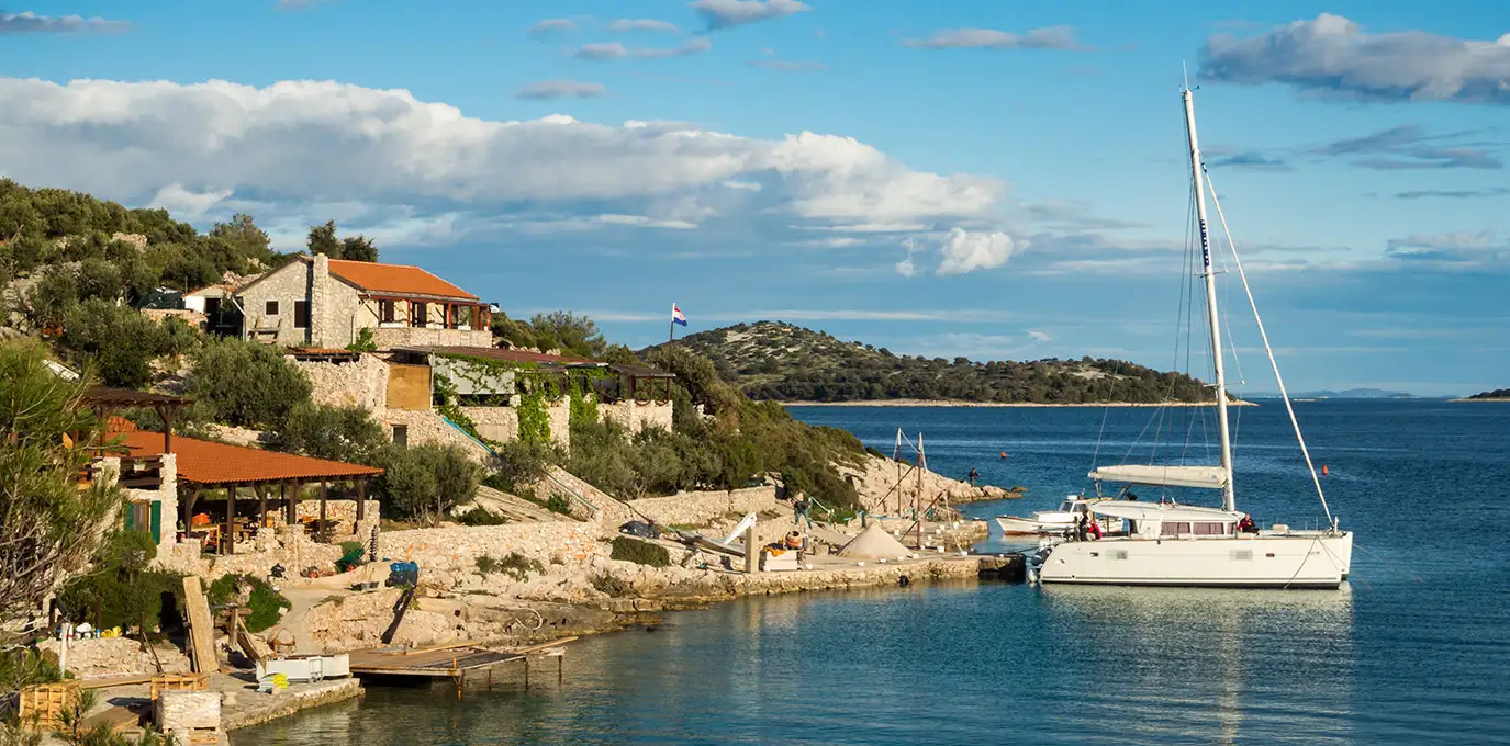
Žut is one of the islands of the Kornati archipelago. It is located between the island of Pašman on the one side, which is connected to the mainland by a boat heading to Ugljan, and the island of Kornat on the other. With a surface of almost 15 km2, this oblong island is only 2 km wide and its highest peak is 172 m high. The inlets of Hiljača, Sarušćica, Bizikovica, Golubovac, Žešnja, Podražanj, Strunac, and others line up along its steep and very indented coastline, providing a Robinsonian atmosphere and possible shelter for small fisherman boats and small sailboats.
There are no permanent settlements on this island covered with olives, figs, and vine, but over the year various fishermen and shepherds, olive producers, and fig pickers from the island of Murter occasionally stay here. Since the Kornati are nautical heaven, there is also a marina with around 120 berths on Žut. Therefore, this place is ideal for everyone coming on their summer vacation with their own or rented boat, since the sea around Žut, as well as the entire Kornati archipelago, is the best spot for water sports.
Sali is a fishing village on Dugi otok, which is the longest island in North Dalmatia. Due to its coastal position, ancient and contemporary architecture, clean sea, plentiful sun, luxurious Mediterranean vegetation, and the thousand-year-old olive groves which surround it, it is ideal for adventurous tourists, but also for those who seek peace in the wonderful atmosphere of enchanting natural surroundings.
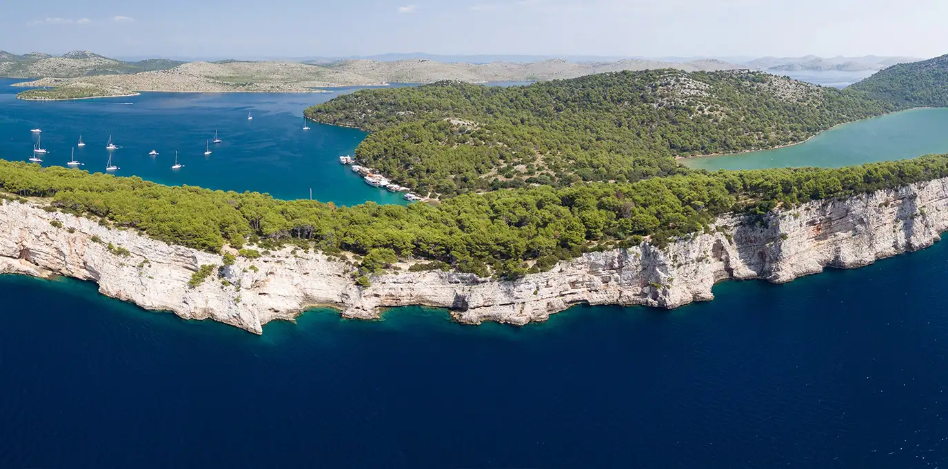
The Telašćica bay, after which the whole Nature Park got its name, is situated on the south-eastern part of the island Dugi otok. It is retracted into the land about 8 km and on its south side is the widest part of about 1.6 km. That part of the bay which is turned towards the southeast is open towards the neighboring Kornati islands. The bay itself is very indented with 25 bays, capes, and 5 islands.
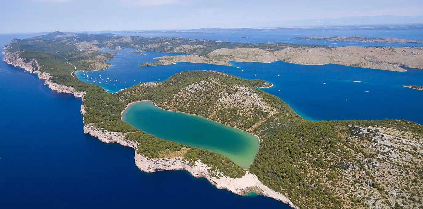
Thanks to its position it is protected from the blows of the north-eastern wind from the mainland and the south wind from the open sea. Because of these features, Telašćica is one of the largest and best-protected natural harbors on the eastern coast of the Adriatic. The name „Telaščica“ probably derives from the Latin name "tre lagus" which means "three lakes". It consists of three parts which are separated by constriction. The bottom of the bay is mostly covered with communities of sea-flowering plants and habitats extremely rich in animal life and very important for the reproduction of many fish species.
According to a legend, the Kornati, a maze of sea passages and islets, was created from a number of rocks God had left over after creating the world. He tossed them into the sea, looked at them, and decided nothing else needed to be corrected.
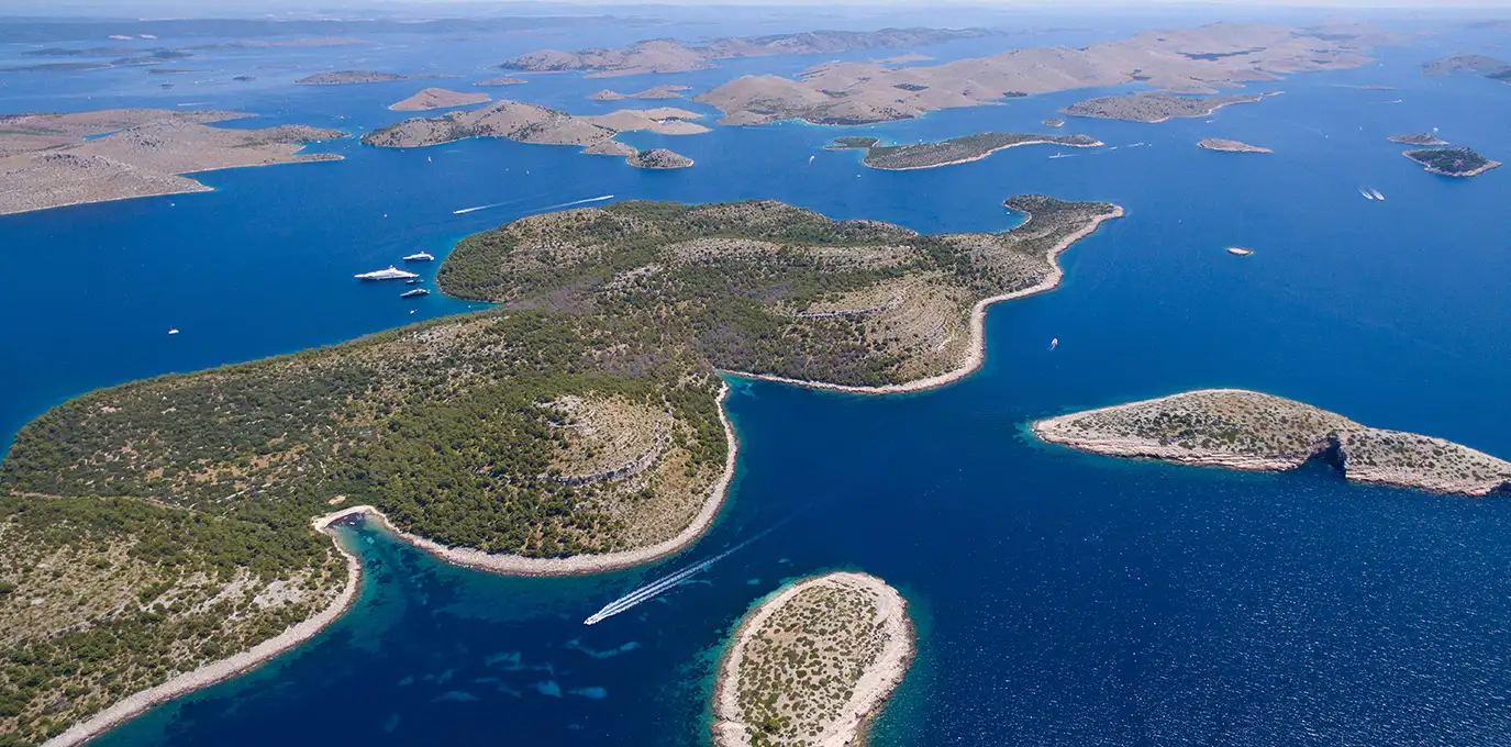
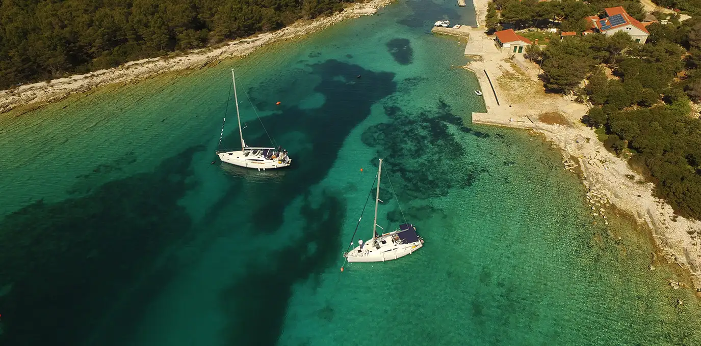
The Kornati archipelago is the most densely grouped cluster of islands in the Mediterranean, consisting of 152 islands, isles, and reefs strewn between the islands of Dugi otok and Žirje, with high cliffs on Klobučar, Mana, and Rašip Veli. Around the isle of Purara, towards the open sea, there is a special submarine reserve. Although the individual islands are small in the area they are attractive not only as a part of kayaking and sailing routes but also as hiking destinations. Clean, clear waters teeming with life are perfect for diving and fishing.
Because of its exceptional landscape beauty, interesting geomorphology, diversity of the coastline, and especially because of the rich biocoenoses of the marine ecosystem, the greater part of the Kornati maritime zone has been declared a national park in 1980.
Today NP “Kornati” occupies an area of about 220 km2 and it includes 89 islands, islets, and cliffs, altogether with a coastline about 238 km long. Despite this relatively large number of islands, the continental part of the park forms only 1 of the total area, while everything else belongs to the marine ecosystem.
Žirje is the remotest inhabited island of the Šibenik Archipelago with great fishing areas and numerous bays for navigators.
Once an island, Primošten has preserved the atmosphere and all the architectural features of a medieval Mediterranean fishing village. The town is dominated by sv. Juraj [St. George] on the highest point of the former island, and the Church of Gospa od Milosti [Our Lady of Mercy] and the chapel of sv. Roko [St. Rocco] certainly attracts our attention.
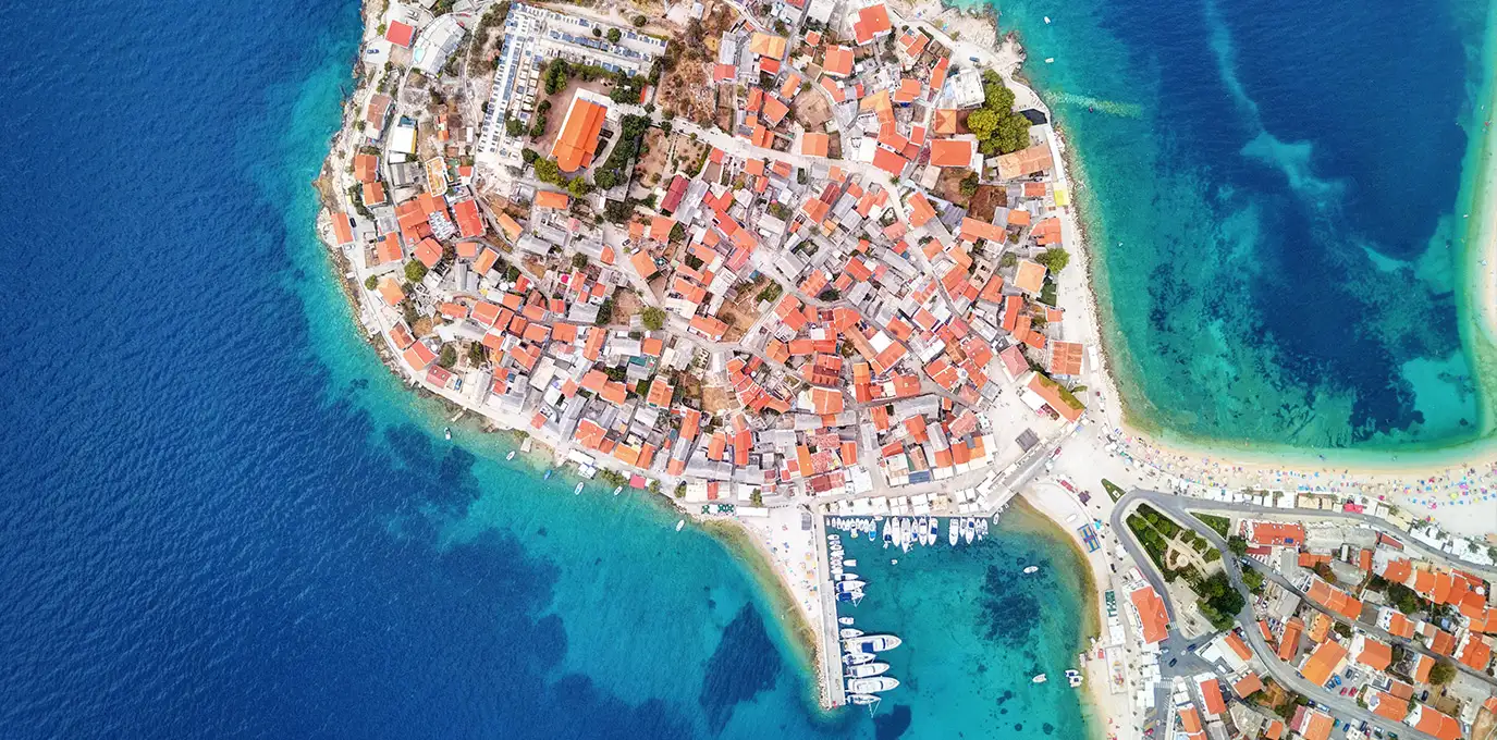
Naturally sheltered from the winds, surrounded by vineyards woven into a stone honeycomb, at the foot of the hills there is the Kremik marina which is unique on the Adriatic. The view of the Babić vines in their stone cells on the nearby slopes is a special experience and testimony to how man's hand can enrich and fertilize even the harshest landscape. On the Raduča peninsula, to the north of the town, in a pine forest, there are hotels and beaches with a wide range of facilities.
The wines of Šibenik’s coastal area and the islands are widely known, especially the autochthonous Babić variety from the vineyards of Primošten – thanks to their beauty, the unusual geographic position, and the barren land on which they grow, they have become a true monument to hardworking peasants. It is no wonder their painting adorns the lobby of the United Nations building in New York.
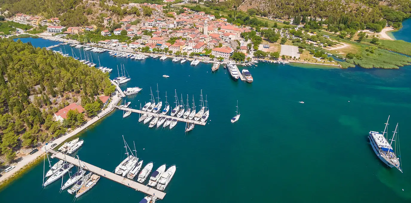
Skradin is an attractive tourist destination whose beauty is crowned by the three most attractive sites in the Krka National Park, Skradin buka waterfalls, Roški waterfall with its ancient mills, and the small Franciscan island of Visovac with a votive sanctuary, rich library, and a cultural and artistic treasury.
National park Krka is Krka river with its seven magical waterfalls which rise near the town of Knin. The area is exceptionally rich in endemic flora and fauna, containing 222 types of birds. The watermills along the rivers and above the waterfalls, ruins of fortifications rising above the canyons, the picturesque mouth of the River Čikola above Skradinski Buk waterfall - all are specific features of the river landscape. The Krka’s estuary, the 23.5 km-long Lake Pruklja, which reaches up to Skradinski Buk is rich in shellfish, freshwater, and saltwater fish. Sitting in Lake Visovac, between Roški slap and Skradinski Buk (13 km) waterfalls, is a tiny island upon which, set amid a park of sylvan charm, is a Franciscan monastery with a long history. The Krka Monastery (Arhanđelovac) is located in the area of Kistanje, at the point where the canyon widens. The quiet river and lakes are ideal for canoe and kayak tours, but for which it is necessary to obtain a special permit.
Kaprije (Italian: Capri di Dalmazia) is an island in the Croatian part of the Adriatic Sea. It is situated in the Šibenik archipelago. It has an area of 6.97 km² and a population of 143, in the eponymous single settlement on the island. The island is composed of hills divided by transversal and longitudinal valleys in which grass and sparse pine forests grow. Grapes and olives are cultivated there. The main industries are agriculture, fishing, and tourism. Automobiles are not allowed on the island.
In the 14th and 15th centuries, the island belonged to noble families from Šibenik. During Ottoman conquests in the 16th and 17th centuries, the island is inhabited by refugees from the mainland. Around that time, a Saint Peter's church was built on the island.
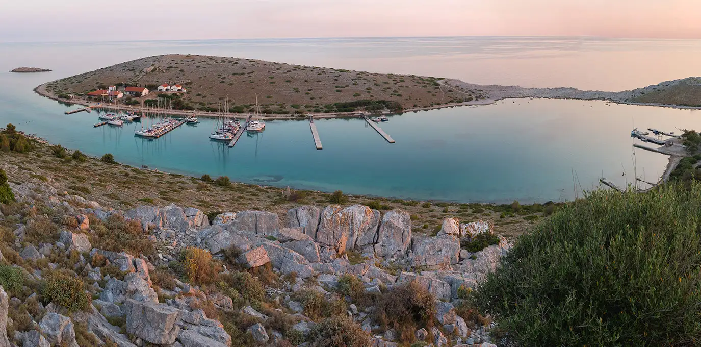
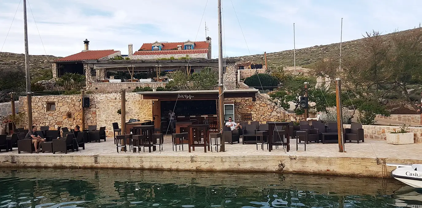
Right down on the southern tip of Kornat is the bay of Opat, two restaurants with small quays and a few mooring buoys. Opat Bay is a small seasonal settlement and anchorage, also known as the Island of lovers. We definitely recommend a nice walk to the hill of Opat from where you can have an amazing view of the whole Kornati archipelago.
Sail all the way through Kornati national park, maybe stop for swimming on Levrnaka. Enjoy one more day of beautiful bays, sailing through preserved islands.
We are very social bunch. Get in touch!